Sketch map showing the head of the Persian Gulf, Musandam Peninsula and Gulf of Oman
IOR/L/PS/10/23, f 140
2 items in this record
Search within this record
The record is made up of 1 paper map. It was created in 7 Dec 1904. It was written in English. The original is part of the British Library: India Office The department of the British Government to which the Government of India reported between 1858 and 1947. The successor to the Court of Directors. Records and Private Papers Documents collected in a private capacity. .
About this record
- Content
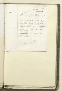
The sketch map, drawn in ink with its sea boundaries outlined in blue pencil, shows the southern portion of Persia, the northern portion of the Arabian littoral, and the Persian Gulf The historical term used to describe the body of water between the Arabian Peninsula and Iran. and Gulf of Oman in between. Various islands, ports and inlets are labelled on the map. The back of the map bears the following inscription in ink: ‘Mr Campbell 17/12/04 Note on flagstaffs in Persian Gulf The historical term used to describe the body of water between the Arabian Peninsula and Iran. .’
- Extent and format
- 1 paper map
- Area map covers
- Map loading...
- Orientation
- North
- Degree coordinates
- Top-left: 28° 25' 48" N, 53° 49' 12" E
Top-right: 28° 25' 48" N, 62° 35' 24" E
Bottom-left: 21° 43' 12" N, 53° 49' 12" E
Bottom-right: 21° 43' 12" N, 62° 35' 24" E - It is part of
- 454 imagesRef: IOR/L/PS/10/23
- Physical characteristics
Materials: paper folio.
Dimensions: 223 mm x 160 mm.
Foliation: The map is foliated in the top right corner with two folio numbers. The circled folio number should be used for referencing, while the uncircled folio number should be disregarded.
- Written in
- English in Latin script
- Type
- Map
Archive information for this record
- Original held at
- British Library: India Office The department of the British Government to which the Government of India reported between 1858 and 1947. The successor to the Court of Directors. Records and Private Papers Documents collected in a private capacity.
- Access conditions
Unrestricted
- Archive reference
- IOR/L/PS/10/23, f 140
- Date(s)
- 7 Dec 1904 (CE, Gregorian)
Access & Reference
History of this record
Use and share this record
- Share this record
- Cite this record in your research
Sketch map showing the head of the Persian Gulf, Musandam Peninsula and Gulf of Oman, British Library: India Office Records and Private Papers, IOR/L/PS/10/23, f 140, in Qatar Digital Library <https://www.qdl.qa/archive/81055/vdc_100026370951.0x000003> [accessed 19 April 2024]
- Link to this record
https://www.qdl.qa/en/archive/81055/vdc_100026370951.0x000003
- IIIF details
This record has a IIIF manifest available as follows. If you have a compatible viewer you can drag the icon to load it.https://www.qdl.qa/en/iiif/81055/vdc_100000000365.0x0003dc/manifestOpen in Universal viewerOpen in Mirador viewerMore options for embedding images
Copyright: How to use this content
- Reference
- IOR/L/PS/10/23, f 140
- Title
- Sketch map showing the head of the Persian Gulf, Musandam Peninsula and Gulf of Oman
- Pages
- 140r:140v
- Author
- East India Company, the Board of Control, the India Office, or other British Government Department
- Usage terms
- Open Government Licence