Overview
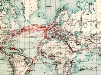
George Barnes Brucks is an important figure in the history of the Indian Navy. Born in England, he went to sea at the age of eleven, and spent sixteen years serving in the Bombay Marine The navy of the East India Company. . In 1820, he was recruited as an assistant to Captain Guy, on board the East India Company’s vessel Psyche, one of three ships engaged on an expedition to survey the coastal waters of the Gulf.
The 1820 Survey
The Bombay Government commissioned the survey for various reasons: ‘to suppress piracy and extend commerce, to maintain the status quo of the chiefs, to exclude foreign influence, and to root out the slave trade’. Guy’s retirement partway through the expedition saw Brucks assume command in his place.
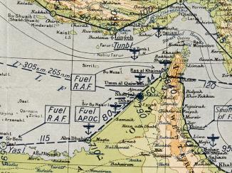
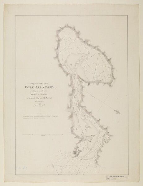
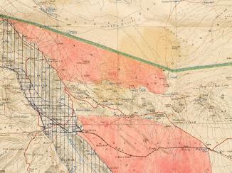
The ten-year-long expedition resulted in the most accurate survey of the Gulf’s shores to date, and produced fourteen charts in total as well as a number of literary works describing the Gulf’s topography, and the trade and customs of its inhabitants. Improvements in scientific measurement meant that the 1820s' expedition maps were soon superseded. The accuracy of the maps were a particular issue; not least because of mistakes made in the calculation of longitude from Bombay, which, it later transpired, was calculated as being seven miles too far to the east.
Brucks’s Memoir Descriptive
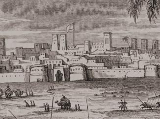
Nevertheless, the 1820s survey of the Gulf has remained significant for its record of the places and peoples that the surveyors encountered. Brucks’s Memoir Descriptive of the Navigation of the Gulf of Persia, published posthumously in 1856, was based on the detailed notes he made in his private journals during the expedition. Given that one of the main reasons for conducting a survey of the waters of the Gulf was British concerns about the ‘pirates’ that inhabited its ports, it’s not surprising that Brucks concentrated on towns such as Ra’s al-Khaymah, which, he noted, had been the principal pirate port in the region prior to East India Company’s marine expedition against it in 1819 and 1829.
Brucks wrote that, before 1819, the port had up to 7000 men and eighty boats, many of which were armed with cannons. There were also around seventy cannons mounted around the walls of the town. Now, wrote Brucks, there were 4500 inhabitants, adding that the town was completely destroyed by British forces, to such an extent that ‘it is now difficult to tell what might have been the form of houses’.
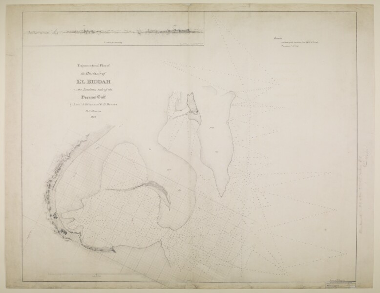
Further west, Brucks navigated the shallow waters and inlets of the coast of Qatar (here referred to as ‘Guttur’), which was now better understood by explorers as a prominent peninsula, jutting out into the Gulf. Along the Qatar coastline Brucks encountered the towns of Al Bidda (or El Biddah), with a population of 400 that swelled to 1200 during the pearl fishing season, and Zubarah 18th-century town located 105 km from Doha. , a large town that had once been a place of considerable trade, but which now lay in ruins.
Related Articles


Brucks’s Later Career
Brucks remained at the vanguard of naval policy and navigation throughout his career. During the 1830s, as Great Britain abolished slavery throughout its Empire, Brucks reported on the continuing trade in slaves between India and Africa. At the end of the 1830s, Brucks was given responsibility for bringing steam frigates from England to India and the Gulf. In 1838, he unsuccessfully attempted to navigate the steamer Semiramis from Bombay to the Red Sea during the south-west monsoon season, a challenge which he described as ‘the bugbear of the Bombay imagination’.
In 1839, three years before his retirement, Brucks returned to the Gulf, but this time as Commodore in charge of the Persian Gulf The historical term used to describe the body of water between the Arabian Peninsula and Iran. Squadron. In 1841, he toured the Gulf once more, in another of the Navy’s new steam frigates, the Sesostris. This tour was less constructive than Brucks’s first, with the Commodore ordering the bombardment of Dubai and Biddah (Doha) as punishment for their ‘piratical’ activities. Both ports had formerly been protected from serious naval bombardment by the shallow waters that lay around them. But the extended range of the Persian Gulf The historical term used to describe the body of water between the Arabian Peninsula and Iran. Squadron’s guns, combined with the improved navigation charts that Brucks himself had helped draw up years earlier, left them vulnerable to the Indian Navy. This episode marked one of Brucks’s last naval forays in the Gulf; after returning to England in 1842, he died in 1850.