Overview
The India Office The department of the British Government to which the Government of India reported between 1858 and 1947. The successor to the Court of Directors. Records (IOR) Map Collection amounts to some 70,000 hand-drawn and printed maps. It comprises single sheets, atlases, written surveys and geographical memoirs dating from the mid-seventeenth century till, in the case of the Aden records, the late 1960s. This material was produced or copied for administrative purposes and arranged geographically with a separate section for large-scale plans.
The Core of the Collection: Nautical Charts and Official Maps
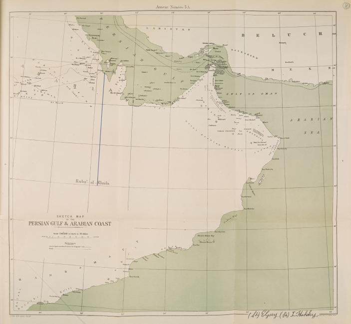
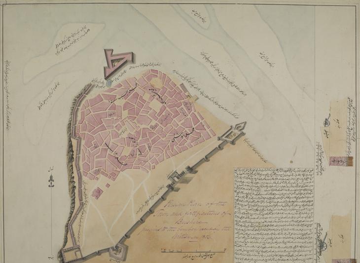
The collection includes material related to regions within the sphere of influence of the East India Company (EIC) and, later, the India Office The department of the British Government to which the Government of India reported between 1858 and 1947. The successor to the Court of Directors. . This includes a significant number of nautical charts, produced by officers in the course of their enterprise, which included exploratory surveys carried out in the late eighteenth and early nineteenth centuries. These are depicted in the large-scale manuscript maps and geographical memoirs.
The core of the collection is made up of official maps associated with the records of the successive British administrations in the region, including the large-scale survey and topographical depiction of the Indian subcontinent. But the collection also comprises official maps of other areas of interest to the British, including the Middle East. By charting the waters within and creating accurate maps of the regions where their interests lay, the EIC ensured that they had an advantage over other competing powers.

A Wide Variety of Other Sources
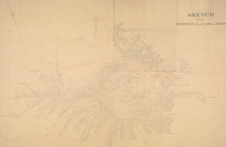
Material was also gathered from other sources, too. The IOR Map Collection incorporates cartographic material produced for general reference – the IOR/X series – in addition to items created by and received in London from the various British Agencies – the IOR/W series. Sometimes maps and plans were removed from other volumes or files, for example, the India Office’s Political and Secret Department, which make up the IOR/W/L/PS/21 series, and were housed for preservation in the Map Room of the India Office The department of the British Government to which the Government of India reported between 1858 and 1947. The successor to the Court of Directors. . Additionally, the Collection contains the entire series devoted to the administration of the Aden settlement (later, the Colony of Aden): IOR/R/20.
From a Chest to the India Office Map Room
Until the late eighteenth century, the EIC’s cartographic material was housed in a chest in their headquarters in the City of London, along with other documents regarded as ‘difficult to manage’. The collection expanded during the nineteenth century with the majority of maps and survey documentation supplied by EIC officers, including a prolific cartographer and chart maker named Alexander Dalrymple (1737–1808), who was the first hydrographer in the British Admiralty.
In the early nineteenth century, it was decided that the Map Collection should be controlled and exploited independently from the rest of the IOR documents: 1867 witnessed the creation of the India Office The department of the British Government to which the Government of India reported between 1858 and 1947. The successor to the Court of Directors. Geographical Department, which was later renamed the India Office The department of the British Government to which the Government of India reported between 1858 and 1947. The successor to the Court of Directors. Map Room. On top of the production of administrative atlases, the Department was also responsible for safeguarding any India Office The department of the British Government to which the Government of India reported between 1858 and 1947. The successor to the Court of Directors. documentation that could be regarded as constituting a survey.
Meanwhile, in the 1860s the Surveyor General’s Office in India established a transfer-lithography department. As a result, responsibility for chart publication of waters east of the Cape of Good Hope was gradually taken over by the Admiralty Hydrographic Department, based in Poona (Pune).
Related Articles
The Collection’s Various Functions
The function of the collection developed over the years. At first it was treated as a resource for the EIC’s marine chart production; later it was used as a reference library. Finally, and most interestingly, from 1871 onwards, the India Office The department of the British Government to which the Government of India reported between 1858 and 1947. The successor to the Court of Directors. Map Room served as the UK sales agent for ‘Survey of India’ maps. Gradually, the Department was to embrace the archival as well as the retail functions of the collection, recognizing that those in charge of the collection had a responsibility to preserve copies of contemporaneously published maps as records.
However, the phenomenon of a map collection functioning simultaneously as an archive, a reference library of printed maps and a sales office for contemporary Indian map production generated some amount of confusion, even amongst those in charge of the collection. This resulted in the removal and destruction of superseded editions of topographical map sheets, mainly those produced between the 1880s and the First World War. As a result, there are historical periods and geographical scopes, which the collection can no longer claim to fully represent.
Furthermore, because the Maps Collection was treated as a reference collection and regarded as a tool primarily, this has resulted in the ‘using up’ of the material over the years. In other words, a large number of items bear extensive annotations. Some items went missing or have been misplaced whilst being moved to other India Office The department of the British Government to which the Government of India reported between 1858 and 1947. The successor to the Court of Directors. departments. Nevertheless, the IOR Map Collection is an incredibly rich resource which offers an unparalleled overview of the India Office’s cartographical production.