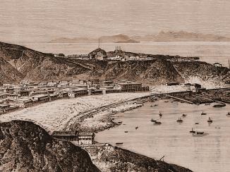
‘SURVEY of ground between Ras Tarshayn and Ras Hedjuff including STEAMER POINT in the Western Bay of ADEN’
IOR/X/3246


2 items in this record
Search within this record
The record is made up of 1 plan. It was created in 1843. It was written in English. The original is part of the British Library: Map Collections.
About this record
- Content
Distinctive Features:
Relief shown by shading.
Depths around Flint Island shown by soundings Measurements of the depth of a body of water. recorded in feet.
Shows position of a coal deposit at the Steamer Point (modern Tawahi), fortifications at Ras Morbut. Landmarks lettered for reference with a table listing calculated distances provided.
Inscriptions:
Bottom left-hand corner:
‘Ex Engineer’s Office Aden 29th November 1843’.
Bottom right-hand corner:
‘Henry W.B. Bell 2nd Lieutenent Actg. Ex. Engineer’.
Signed by a Special Committee on the Aden Defences formed of Engineers William Jacob and C.W. Grant, Bombay April 23rd 1844.
Labels:
On verso The back of a sheet of paper or leaf, often abbreviated to 'v'. , upper right: ‘Duplicate ADEN Survey from Ras Tarsheyn to Ras Hedjuff Including Steamer Point and Flint Island. No. 30’.
- Extent and format
- 1 plan
- Area map covers
- Map loading...
- Scale
- not given
- Scale designator
- Horizontal
- Orientation
- South
- Degree coordinates
- Top-left: 12° 47' 56.35" N, 44° 58' 9.46" E
Top-right: 12° 47' 56.35" N, 45° 0' 7.98" E
Bottom-left: 12° 46' 35.84" N, 44° 58' 9.46" E
Bottom-right: 12° 46' 35.84" N, 45° 0' 7.98" E - Physical characteristics
Materials:
Pen and ink with wash on paper
Dimensions:
758 x 1310 mm
- Written in
- English in Latin script
- Type
- Map
Archive information for this record
- Original held at
- British Library: Map Collections
- Access conditions
Unrestricted
- Archive reference
- IOR/X/3246
- Former British Library reference
- M.IX.16
- Date(s)
- 1843 (CE, Gregorian)
Access & Reference
History of this record
Related material
Related search terms
- Places
- Aden
- People & organisations
- C.W. GrantWilliam Jacob
Use and share this record
- Share this record
- Cite this record in your research
‘SURVEY of ground between Ras Tarshayn and Ras Hedjuff including STEAMER POINT in the Western Bay of ADEN’, British Library: Map Collections, IOR/X/3246, in Qatar Digital Library <https://www.qdl.qa/archive/81055/vdc_100000010744.0x000001> [accessed 24 April 2024]
- Link to this record
https://www.qdl.qa/en/archive/81055/vdc_100000010744.0x000001
- IIIF details
This record has a IIIF manifest available as follows. If you have a compatible viewer you can drag the icon to load it.https://www.qdl.qa/en/iiif/81055/vdc_100000010744.0x000001/manifestOpen in Universal viewerOpen in Mirador viewerMore options for embedding images
Copyright: How to use this content
- Reference
- IOR/X/3246
- Title
- ‘SURVEY of ground between Ras Tarshayn and Ras Hedjuff including STEAMER POINT in the Western Bay of ADEN’
- Pages
- 1r:1v
- Author
- Please see item description
- Usage terms
- Public Domain