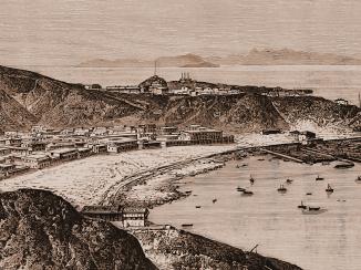
‘[Plan] OF THE WORKS ON THE SUMMIT OF THE CONICAL HILL IN REAR OF RAS-MORBAT’
IOR/X/3254

2 items in this record
Search within this record
The record is made up of 1 sheet. It was created in 1846. It was written in English. The original is part of the British Library: Map Collections.
About this record
- Content
Distinctive Features:
Space in the first line of title left blank.
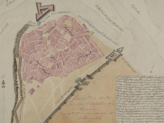
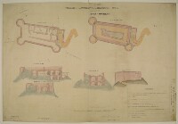
Includes ground plan and ‘PLAN OF TERRE PLEIN’ of Ras-Morbat Fort with corresponding longitudinal sections and elevations. Lettered for reference with a key in the bottom right-hand corner. Measurements reported.
Inscriptions:
On recto The front of a sheet of paper or leaf, often abbreviated to 'r'. , bottom left-hand corner: ‘Isthmus Office July 15th 1846 Drawn by F. Welsh’.
‘Copied in the Chief Engrs. Office Bombay 26th September 1846’.
On recto The front of a sheet of paper or leaf, often abbreviated to 'r'. , bottom center: ‘/Signed/ J. Kilner Captain Executive Engineer Aden’.
On verso The back of a sheet of paper or leaf, often abbreviated to 'v'. , bottom left-hand corner with bleed-through into the recto The front of a sheet of paper or leaf, often abbreviated to 'r'. :
‘In Bombay Secret Lre. No. 113 of 1846 Recd. via Southampton 10th Novr. 1846 Aden Fortifications’.
- Extent and format
- 1 sheet
- Area map covers
- Map loading...
- Scale
- differ
- Scale designator
- Horizontal
- Orientation
- North
- Degree coordinates
- Top-left: 12° 47' 44.89" N, 44° 58' 15.33" E
Top-right: 12° 47' 44.89" N, 44° 59' 42.65" E
Bottom-left: 12° 46' 49.71" N, 44° 58' 15.33" E
Bottom-right: 12° 46' 49.71" N, 44° 59' 42.65" E - Physical characteristics
Materials:
Pen and ink with wash on tracing paper
Dimensions:
695 x 1022 mm
- Written in
- English in Latin script
- Type
- Map
Archive information for this record
- Original held at
- British Library: Map Collections
- Access conditions
Unrestricted
- Archive reference
- IOR/X/3254
- Former British Library reference
- M.IX.24
- Date(s)
- 1846 (CE, Gregorian)
Access & Reference
History of this record
Related material
Use and share this record
- Share this record
- Cite this record in your research
‘[Plan] OF THE WORKS ON THE SUMMIT OF THE CONICAL HILL IN REAR OF RAS-MORBAT’, British Library: Map Collections, IOR/X/3254, in Qatar Digital Library <https://www.qdl.qa/archive/81055/vdc_100000010772.0x000001> [accessed 20 April 2024]
- Link to this record
https://www.qdl.qa/en/archive/81055/vdc_100000010772.0x000001
- IIIF details
This record has a IIIF manifest available as follows. If you have a compatible viewer you can drag the icon to load it.https://www.qdl.qa/en/iiif/81055/vdc_100000010772.0x000001/manifestOpen in Universal viewerOpen in Mirador viewerMore options for embedding images
Copyright: How to use this content
- Reference
- IOR/X/3254
- Title
- ‘[Plan] OF THE WORKS ON THE SUMMIT OF THE CONICAL HILL IN REAR OF RAS-MORBAT’
- Pages
- 1r:1v
- Author
- Please see item description
- Usage terms
- Public Domain