!['ROUTES IN PERSIA. SECTION III' [‎132v] (269/739)](https://iiif.qdl.qa/iiif/images/81055/vdc_100000001491.0x000114/Mss Eur F111_371_0267.jp2/full/!1200,1200/0/default.jpg "'ROUTES IN PERSIA. SECTION III' [‎132v] (269/739)")
'ROUTES IN PERSIA. SECTION III' [132v] (269/739)
The record is made up of 1 volume (367 folios). It was created in 1898. It was written in English. The original is part of the British Library: India Office The department of the British Government to which the Government of India reported between 1858 and 1947. The successor to the Court of Directors. Records and Private Papers Documents collected in a private capacity. .
Transcription
This transcription is created automatically. It may contain errors.
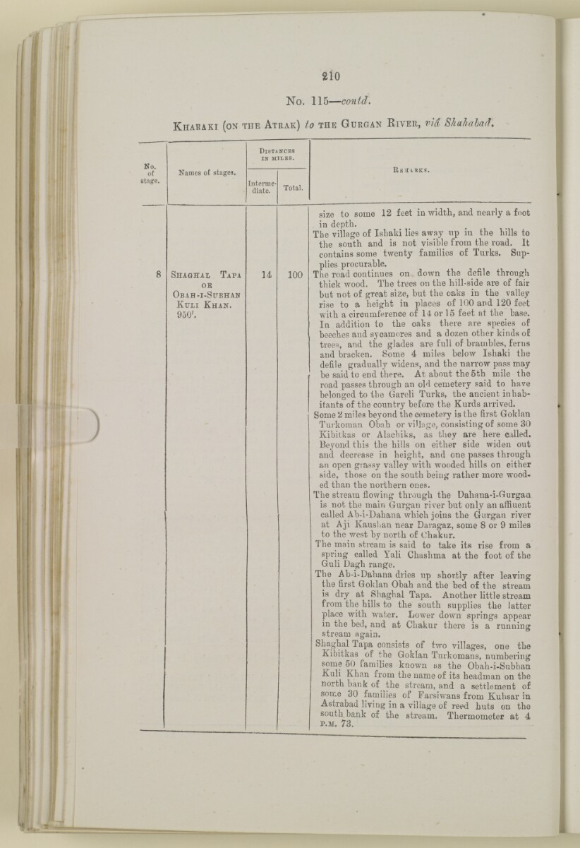
aio
No. 115 — contd,
K habaki (on the A trak) to the G urgan R iver, via Shahahad,
No.
of
stage.
Names of stages.
D istances
in miles.
Interme
diate.
Shaghal Tapa
OE
O bah - i -S ubhan
Kuli Khan.
950'.
14
Total.
100
e,a\i^rk3.
size to some 12 feet in width, and nearly a foot
in depth.
The village of Ishaki lies away np in the hills to
the south and is not visible from the road. It
contains some twenty families of Turks. Sup
plies procurable.
The road continues on down the defile through
thick wood. The trees on the hill-side are of fair
but not of great size, but the oaks in the valley
rise to a height in places of 100 and 120 feet
with a circumference of 14 or 15 feet at the base.
In addition to the oaks there are species of
beeches and sycamores and a dozen other kinds of
trees, and the glades are full of brambles, ferns
and bracken. Some 4 miles below Ishaki the
defile gradually widens, and the narrow pass may
be said to end there. At about the 5th mile the
road passes through an old cemetery said to have
belonged to the Gareli Turks, the ancient inhab
itants of the country before the Kurds arrived.
Some 2 miles beyond the cemetery is the first Goklan
Turkoman Obah or village, consisting of some 30
Kibitkas or Alachiks, as they are here called.
Beyond this the hills on either side widen out
and decrease in height, and one passes through
an open grassy valley with wooded hills on either
side, those on the south being rather more wood
ed than the northern ones.
The stream flowing through the Dahana-i-Ourgaa
is not the main Gurgan river but only an affluent
called Ab-i-Dahana which joins the Gurgan river
at Aji Kaushan near Daragaz, some 8 or 9 miles
to the west by north of Ohakur.
The main stream is said to take its rise from a
spring called Yali Chashma at the foot of the
Guli Dagh ran^e.
The Ab-i-Dahana dries up shortly after leaving
the first Goklan Obah and the bed of the stream
is dry at Shaghal Tapa. Another little stream
from the hills to the south supplies the latter
place with water. Lower down springs appear
in the bed, and at Chakur there is a running
stream again.
Shaghal Tapa consists of two villages, one the
Kibitkas of the Goklan Turkomans, numbering
some 50 families known as the Obah-i-Subhan
Kuli Khan from the name of its headman on the
north bank of the stream, and a settlement of
some 30 families of Farsiwans from Kuhsar in
Astrabad living in a village of reed huts on the
south bank of the stream, Thermometer at 4
p.m . 73.
About this item
- Content
The volume is a Government of India official publication entitled Routes in Persia. Section III. Compiled in the Intelligence Branch of the Quarter Master General's Department in India (Simla: printed at the Government Central Printing Office, 1898).
The volume contains details of all land routes (numbered 1-247) in Persia starting from Russian territory and extending south as far as a line drawn from Karmanshah [Kermānshāh] south-eastwards through Burujird [Borūjerd], Isfahan [Eşfahān] and Yazd to Karman [Kermān], and thence north-east to Khabis [Khabīş] and Neh to Lash Juwain [Lāsh-e Juwayn].
The information given for each route comprises:
- number of route;
- place names forming starting point and destination of route;
- authority and date;
- number of stage;
- names of stages;
- distance in miles (intermediate and total);
- remarks (including precise details of the route, general geographical information, and information on smaller settlements, local peoples, agriculture, condition of roads, access to water, supplies of wood, and other routes).
An appendix within the volume (folios 356-359) and two separately-stored sets of loose sheets (containing routes numbers 77 (a) and 140-A, folios 363-369) give information too late for incorporation in the body of the work.
The volume also contains pockets attached to the front and back inside covers for maps. These consist of an index map showing the limits of each of the three sections of Routes in Persia (folio 2) and an index map to the routes in Section III (folio 361). There is also a fold-out map of the route from Seistan [Sīstān] to Mashad on folio 232.
An ink stamp on the front cover records the confidential nature of the publication and that it was being transmitted for the information of His Excellency the Viceroy (Victor Alexander Bruce, 9th Earl of Elgin and 16th Earl of Kincardine) only.
- Extent and format
- 1 volume (367 folios)
- Arrangement
The volume contains an alphabetical cross index (folios 6-17), and an alphabetical index to names of places (folios 18-25).
- Physical characteristics
Foliation: the foliation sequence commences at the front cover and terminates on the last page of the loose supplementary sheets (found in the small grey folder within the main folder); these numbers are written in pencil, are circled, and are located in the top right corner of the recto The front of a sheet of paper or leaf, often abbreviated to 'r'. side of each folio.
Pagination: the volume also contains a printed pagination sequence.
- Written in
- English in Latin script View the complete information for this record
Use and share this item
- Share this item
'ROUTES IN PERSIA. SECTION III' [132v] (269/739), British Library: India Office Records and Private Papers, Mss Eur F111/371, in Qatar Digital Library <https://www.qdl.qa/archive/81055/vdc_100024054421.0x000044> [accessed 19 April 2024]
https://www.qdl.qa/en/archive/81055/vdc_100024054421.0x000044
Copy and paste the code below into your web page where you would like to embed the image.
<meta charset="utf-8"><a href="https://www.qdl.qa/en/archive/81055/vdc_100024054421.0x000044">'ROUTES IN PERSIA. SECTION III' [‎132v] (269/739)</a> <a href="https://www.qdl.qa/en/archive/81055/vdc_100024054421.0x000044"> <img src="https://iiif.qdl.qa/iiif/images/81055/vdc_100000001491.0x000114/Mss Eur F111_371_0267.jp2/full/!280,240/0/default.jpg" alt="" /> </a>
This record has a IIIF manifest available as follows. If you have a compatible viewer you can drag the icon to load it.https://www.qdl.qa/en/iiif/81055/vdc_100000001491.0x000114/manifestOpen in Universal viewerOpen in Mirador viewerMore options for embedding images
Copyright: How to use this content
- Reference
- Mss Eur F111/371
- Title
- 'ROUTES IN PERSIA. SECTION III'
- Pages
- front, back, spine, edge, head, tail, front-i, 2r:58r, 59r:232r, 232r:233r, 234r:361v, back-i, 363r:363v, 365r:369v
- Author
- East India Company, the Board of Control, the India Office, or other British Government Department
- Usage terms
- Open Government Licence