‘Trigonometrical Survey of the Harbours of Muttra and Muscat on the Coast of Arabia. By Lieut.ts G.B. Brucks & S.B. Haines, Hon. E.I.C. Marine, 1828. Engraved by Richard Bateman’
IOR/X/3630/15

2 items in this record
Search within this record
The record is made up of 1 map. It was created in 1 Jul 1831. It was written in English. The original is part of the British Library: Map Collections.
About this record
- Content
Imprint:
Published by James Horsburgh, Hydrographer to the East India Company.
Distinctive Features:
Relief shown by hachures. Depth shown by soundings Measurements of the depth of a body of water. .
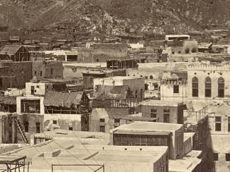
Nautical chart of the shores of the Gulf of Oman showing the coastline between Muttra (Muttrah) and Muscat compiled from the surveys carried out by the Bombay Marine’s officers between 1820 and 1829. Settlements represented pictorially.
- Extent and format
- 1 map
- Area map covers
- Map loading...
- Scale
- Scale approximately 1:8,000
- Scale designator
- Horizontal
- Orientation
- North
- Degree coordinates
- Top-left: 23° 38' 34.63" N, 58° 33' 2.49" E
Top-right: 23° 38' 34.63" N, 58° 36' 37.11" E
Bottom-left: 23° 36' 13.56" N, 58° 33' 2.49" E
Bottom-right: 23° 36' 13.56" N, 58° 36' 37.11" E - It is part of
- 60 imagesRef: IOR/X/3630
- Physical characteristics
Dimensions: 404 x 770 mm, on sheet 470 x 858 mm
- Written in
- English in Latin script
- Type
- Map
Archive information for this record
- Original held at
- British Library: Map Collections
- Access conditions
Unrestricted
- Archive reference
- IOR/X/3630/15
- Date(s)
- 1 Jul 1831 (CE, Gregorian)
Access & Reference
History of this record
Related search terms
- Places
- MuscatMaṭraḥ
- People & organisations
- James HorsburghGeorge Edward BrucksStafford Bettesworth HainesRichard Bateman
Use and share this record
- Share this record
- Cite this record in your research
‘Trigonometrical Survey of the Harbours of Muttra and Muscat on the Coast of Arabia. By Lieut.ts G.B. Brucks & S.B. Haines, Hon. E.I.C. Marine, 1828. Engraved by Richard Bateman’, British Library: Map Collections, IOR/X/3630/15, in Qatar Digital Library <https://www.qdl.qa/archive/81055/vdc_100024174406.0x000017> [accessed 18 April 2024]
- Link to this record
https://www.qdl.qa/en/archive/81055/vdc_100024174406.0x000017
- IIIF details
This record has a IIIF manifest available as follows. If you have a compatible viewer you can drag the icon to load it.https://www.qdl.qa/en/iiif/81055/vdc_100022840540.0x000001/manifestOpen in Universal viewerOpen in Mirador viewerMore options for embedding images
Copyright: How to use this content
- Reference
- IOR/X/3630/15
- Title
- ‘Trigonometrical Survey of the Harbours of Muttra and Muscat on the Coast of Arabia. By Lieut.ts G.B. Brucks & S.B. Haines, Hon. E.I.C. Marine, 1828. Engraved by Richard Bateman’
- Pages
- 10r:10v
- Author
- Please see item description
- Usage terms
- Public Domain