'JABAL-I-MEHDI AREA. Kalat State and Masqat Territory.
IOR/R/15/1/696, f 10

2 items in this record
Search within this record
The record is made up of 1 map sheet. It was created in 1937. It was written in English. The original is part of the British Library: India Office The department of the British Government to which the Government of India reported between 1858 and 1947. The successor to the Court of Directors. Records and Private Papers Documents collected in a private capacity. .
About this record
- Content
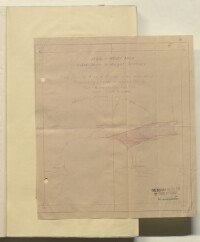
Plan showing Area 42.1 square miles over which a prospecting licence is applied for the by the Burmah Oil Company Limited.
The map shows the Gwadur's location on the Persian Gulf The historical term used to describe the body of water between the Arabian Peninsula and Iran. coastline and the area inland which the company desire a prospecting licence for. Also marked on the map is the approximate boundary of Masqat [Muscat] territory. The area to be prospected is marked with red lines and reference points which are detailed in the accompanying schedule (folio 9) and the area within the red lines is shaded in a lighter red.
The plan contains the Burmah Oil Company's ink stamp certifying its approval by their legal adviser and contains the signature M W Walter.
- Extent and format
- 1 map sheet
- Area map covers
- Map loading...
- Scale
- 1:4
- Scale designator
- Horizontal
- Orientation
- North
- Degree coordinates
- Top-left: 25° 27' 58.46" N, 62° 2' 42.96" E
Top-right: 25° 27' 58.46" N, 62° 29' 56.59" E
Bottom-left: 25° 2' 12.78" N, 62° 2' 42.96" E
Bottom-right: 25° 2' 12.78" N, 62° 29' 56.59" E - It is part of
- 446 imagesRef: IOR/R/15/1/696
- Physical characteristics
Foliation: A pencil number enclosed in a circle is located in the top right hand corner of the map sheet.
Dimensions: 257mm x 257mm
Materials: Parchment sheet.
- Written in
- English in Latin script
- Type
- Map
Archive information for this record
- Original held at
- British Library: India Office The department of the British Government to which the Government of India reported between 1858 and 1947. The successor to the Court of Directors. Records and Private Papers Documents collected in a private capacity.
- Access conditions
Unrestricted
- Archive reference
- IOR/R/15/1/696, f 10
- Date(s)
- 1937 (CE, Gregorian)
Access & Reference
History of this record
Use and share this record
- Share this record
- Cite this record in your research
'JABAL-I-MEHDI AREA. Kalat State and Masqat Territory., British Library: India Office Records and Private Papers, IOR/R/15/1/696, f 10, in Qatar Digital Library <https://www.qdl.qa/archive/81055/vdc_100025803221.0x000002> [accessed 17 April 2024]
- Link to this record
https://www.qdl.qa/en/archive/81055/vdc_100025803221.0x000002
- IIIF details
This record has a IIIF manifest available as follows. If you have a compatible viewer you can drag the icon to load it.https://www.qdl.qa/en/iiif/81055/vdc_100000000193.0x00029e/manifestOpen in Universal viewerOpen in Mirador viewerMore options for embedding images
Copyright: How to use this content
- Reference
- IOR/R/15/1/696, f 10
- Title
- 'JABAL-I-MEHDI AREA. Kalat State and Masqat Territory.
- Pages
- 10r:10v
- Author
- Burmah Oil Company Limited
- Copyright
- ©BP is believed to be the rightsholder
- Usage terms
- Creative Commons Non-Commercial Licence