![‘Sketch to illustrate cable dispute, Bunder Abbas’ [‎28v] (2/2)](https://iiif.qdl.qa/iiif/images/81055/vdc_100000000365.0x00037c/IOR_L_PS_10_39_0062.jp2/full/!1200,1200/0/default.jpg "‘Sketch to illustrate cable dispute, Bunder Abbas’ [‎28v] (2/2)")
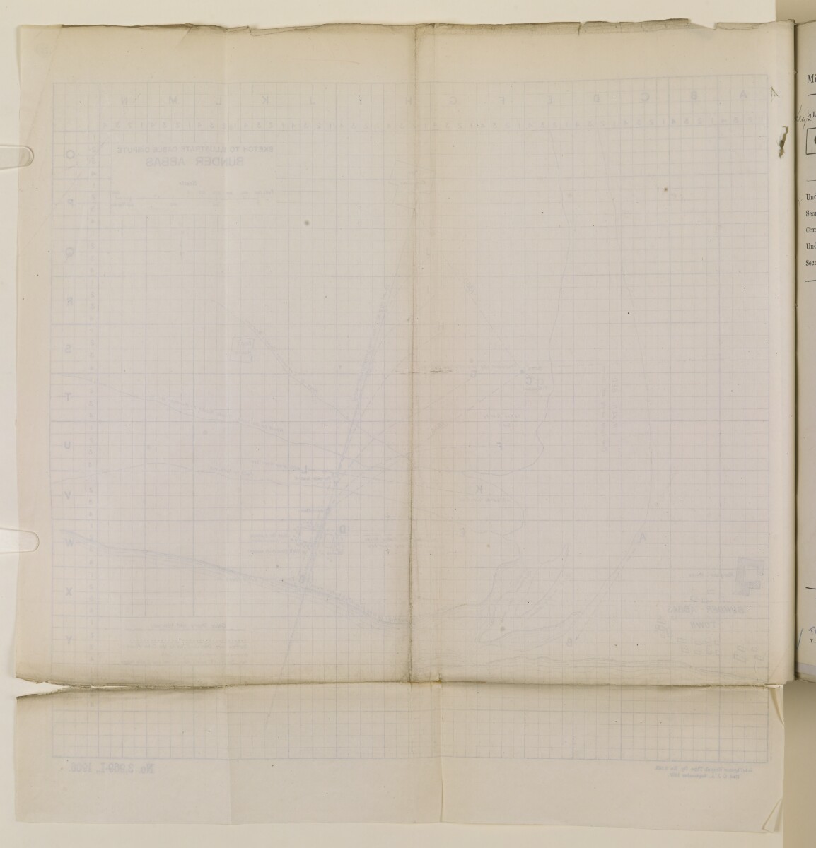
‘Sketch to illustrate cable dispute, Bunder Abbas’ [28v] (2/2)
The record is made up of 1 map. It was created in Sep 1906. It was written in English. The original is part of the British Library: India Office The department of the British Government to which the Government of India reported between 1858 and 1947. The successor to the Court of Directors. Records and Private Papers Documents collected in a private capacity. .
About this item
- Content
The map, drawn on sectional paper with quarter inch squares, covers an area to the east of Bunder Abbas [Bandar-e ʻAbbās] town, with indications of proposed routes of the telegraph cable (linking the town with Jazīreh-ye Hengām) and its associated buildings. The map should be read in conjunction with a letter from the Political Resident A senior ranking political representative (equivalent to a Consul General) from the diplomatic corps of the Government of India or one of its subordinate provincial governments, in charge of a Political Residency. in the Persian Gulf The historical term used to describe the body of water between the Arabian Peninsula and Iran. , Major Percy Zachariah Cox, to HM’s Minister at Tehran, dated 17 August 1906 (ff 24-25 in the same volume), which outlines the proposed routes for the telegraph cable (and the technical difficulties associated with the proposed routes) in an attempt to resolve the dispute between the British and Persian authorities over the position of the telegraph office at Bunder Abbas. In addition to the proposed routes of the cable, the cable house, and Bunder Abbas town, the map also indicates the position of the new British consulate buildings, Monsier Stas’s house, and a Persian guard house. Points on the map marked with the alphabetical labels A through to L are referred to in Cox’s letter.
- Extent and format
- 1 map
- Scale
- 1:4500
- Scale designator
- Horizontal
- Physical characteristics
Materials: Black ink on paper.
Dimensions: 420 x 420 mm.
Foliation: The map is foliated in the top right corner with a circled pencil number.
- Written in
- English in Latin script View the complete information for this record
Use and share this item
- Share this item
‘Sketch to illustrate cable dispute, Bunder Abbas’ [28v] (2/2), British Library: India Office Records and Private Papers, IOR/L/PS/10/39, f 28, in Qatar Digital Library <https://www.qdl.qa/archive/81055/vdc_100026544900.0x00003e> [accessed 19 April 2024]
https://www.qdl.qa/en/archive/81055/vdc_100026544900.0x00003e
Copy and paste the code below into your web page where you would like to embed the image.
<meta charset="utf-8"><a href="https://www.qdl.qa/en/archive/81055/vdc_100026544900.0x00003e">‘Sketch to illustrate cable dispute, Bunder Abbas’ [‎28v] (2/2)</a> <a href="https://www.qdl.qa/en/archive/81055/vdc_100026544900.0x00003e"> <img src="https://iiif.qdl.qa/iiif/images/81055/vdc_100000000365.0x00037c/IOR_L_PS_10_39_0062.jp2/full/!280,240/0/default.jpg" alt="" /> </a>
This record has a IIIF manifest available as follows. If you have a compatible viewer you can drag the icon to load it.https://www.qdl.qa/en/iiif/81055/vdc_100000000365.0x00037c/manifestOpen in Universal viewerOpen in Mirador viewerMore options for embedding images
Copyright: How to use this content
- Reference
- IOR/L/PS/10/39, f 28
- Title
- ‘Sketch to illustrate cable dispute, Bunder Abbas’
- Pages
- 28r:28v
- Author
- East India Company, the Board of Control, the India Office, or other British Government Department
- Usage terms
- Open Government Licence