!['PERSIAN GULF AND ADJACENT COUNTRIES' [‎252v] (2/2)](https://iiif.qdl.qa/iiif/images/81055/vdc_100000000419.0x0000a4/IOR_L_PS_10_271_0514.jp2/full/!1200,1200/0/default.jpg "'PERSIAN GULF AND ADJACENT COUNTRIES' [‎252v] (2/2)")
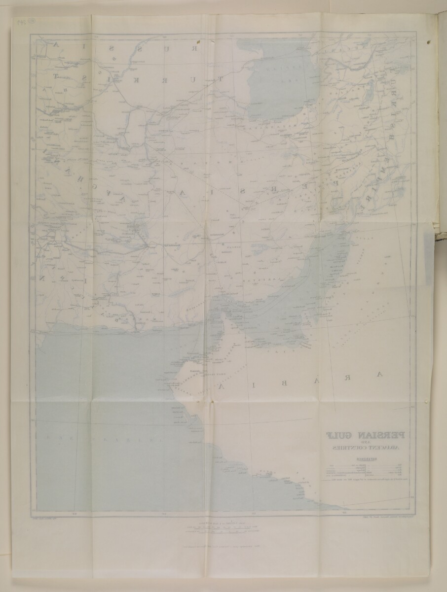
'PERSIAN GULF AND ADJACENT COUNTRIES' [252v] (2/2)
The record is made up of 1 map. It was created in Jun 1908. It was written in English. The original is part of the British Library: India Office The department of the British Government to which the Government of India reported between 1858 and 1947. The successor to the Court of Directors. Records and Private Papers Documents collected in a private capacity. .
About this item
- Content
Map of the Persian Gulf The historical term used to describe the body of water between the Arabian Peninsula and Iran. region, to accompany Bagdad Railway No. 1 (1911). Presented to both Houses of Parliament by Command of His Majesty, May 1911 (London, His Majesty's Stationery Office). The publication appears on folios 215-252.
The map was produced by the Topographical Section of the General Staff, War Office.
- Extent and format
- 1 map
- Area map covers
- Map loading...
- Scale
- 1:4,055,040
- Scale designator
- Horizontal
- Orientation
- North
- Degree coordinates
- Top-left: 42° 32' 12.84" N, 41° 58' 4.08" E
Top-right: 42° 32' 12.84" N, 68° 57' 0.72" E
Bottom-left: 14° 52' 51.96" N, 41° 58' 4.08" E
Bottom-right: 14° 52' 51.96" N, 68° 57' 0.72" E - Physical characteristics
Material: printed on paper.
Dimensions: 720 x 560mm, on sheet 850 x 620mm.
- Written in
- English in Latin script View the complete information for this record
Use and share this item
- Share this item
'PERSIAN GULF AND ADJACENT COUNTRIES' [252v] (2/2), British Library: India Office Records and Private Papers, IOR/L/PS/10/271, f 252, in Qatar Digital Library <https://www.qdl.qa/archive/81055/vdc_100036166451.0x00006e> [accessed 23 April 2024]
https://www.qdl.qa/en/archive/81055/vdc_100036166451.0x00006e
Copy and paste the code below into your web page where you would like to embed the image.
<meta charset="utf-8"><a href="https://www.qdl.qa/en/archive/81055/vdc_100036166451.0x00006e">'PERSIAN GULF AND ADJACENT COUNTRIES' [‎252v] (2/2)</a> <a href="https://www.qdl.qa/en/archive/81055/vdc_100036166451.0x00006e"> <img src="https://iiif.qdl.qa/iiif/images/81055/vdc_100000000419.0x0000a4/IOR_L_PS_10_271_0514.jp2/full/!280,240/0/default.jpg" alt="" /> </a>
This record has a IIIF manifest available as follows. If you have a compatible viewer you can drag the icon to load it.https://www.qdl.qa/en/iiif/81055/vdc_100000000419.0x0000a4/manifestOpen in Universal viewerOpen in Mirador viewerMore options for embedding images
Copyright: How to use this content
- Reference
- IOR/L/PS/10/271
- Title
- File 1808/1912 'Bagdad Railway. Navigation of the Tigris & Lynch's Agreement with the Company for the transport of railway material.'
- Pages
- 215r:253v
- Author
- Privy Council Office
- Usage terms
- Public Domain