![‘Military report on south-west Persia, including the provinces of Khúzistán (Arabistan), Luristán and part of Fars.’ [‎114v] (233/470)](https://iiif.qdl.qa/iiif/images/81055/vdc_100000000239.0x00012f/IOR_L_MIL_17_15_9_0255.jp2/full/!1200,1200/0/default.jpg "‘Military report on south-west Persia, including the provinces of Khúzistán (Arabistan), Luristán and part of Fars.’ [‎114v] (233/470)")
‘Military report on south-west Persia, including the provinces of Khúzistán (Arabistan), Luristán and part of Fars.’ [114v] (233/470)
The record is made up of 1 volume (231 folios). It was created in 1885. It was written in English. The original is part of the British Library: India Office The department of the British Government to which the Government of India reported between 1858 and 1947. The successor to the Court of Directors. Records and Private Papers Documents collected in a private capacity. .
Transcription
This transcription is created automatically. It may contain errors.
218
Route No. 1— contd.
From Muhammerah to Tehran, $•£.*—contd.
o
u •
Distances in
miles.
% **
II
Time.
Names of towns, villages, &e.
Interme
diate.
Total.
Remarks.
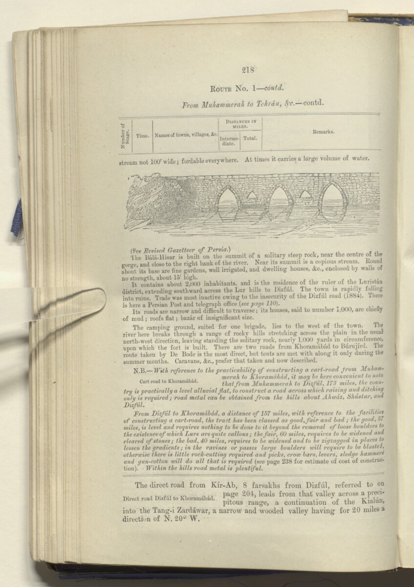
stream not 100' wide; fordable everywhere. At times it carries a large volume of water
(See Revised Gazetteer of Persia.) . ,
'the Bala-Hisar is built on the summit of a solitary steep rock, near the centre of the
gorge, and close to the right bank of the river. Near its summit is a copious stream. Round
about its base are line gardens, well irrigated, and dwelling houses, &c., enclosed by walls of
no strength, about 15'high.
It contains about 2,000 inhabitants, and is the residence of the ruler of the Luristan
district, extending southward across the Lur hills to Dizful. The town is rapidly falling
into ruins. Trade was most inactive owing to the insecurity of the Dizful road (1884). There
is here a Persian Post and telegraph office {see page 110). _ .
Its roads are narrow and difficult to traverse; its houses, said to number j.,000, are chietty
of mud ; roofs flat; bazar of insignificant size.
The camping ground, suited for one brigade, lies to the west of the town. The
river here breaks through a range of rocky hills stretching across the plain in the usual
north-west direction, leaving standing the solitary rock, nearly 1,000 yards in circumference,
upon which the fort is built. There are two roads from Khoramabiid to Bdrujird. The
route taken by De Bode is the most direct, but tents are met with along it only during the
summer months. Caravans, &c., prefer that taken and now described.
N.B.— With reference to the practicability of constructing a cart-road from 3fuhdim
mer ah to Khoramdbdd, it may be here convenient to note
Cart road to Khoramibad. that from Muhammerah to Dizful, 178 miles, the conn-
try is practically a level alluvial flat, to construct a road across which raising and ditching
only is required; road metal can be obtained from the hills about Ahwdz, Shustar, and
Dizful.
From Dizful to Khoramdbdd, a distance of 157 miles, with reference to the facilities
of constructing a cart-road, the tract has been classed as good, fair and bad ; the good, 57
miles, is level and requires nothing to be done to it beyond the removal of loose boulders to
the existence of which Lurs are quite callous ; the fair, 60 miles, requires to be widened and
cleared of stones ; the bad, 40 miles, requires to be widened and to be zigzagged in places to
lessen the gradients; in the ravines or passes large boulders will require to be blasted,
otherwise there is little rock-cutting required and picks, croio bars, levers, sledge hammers
and gun-cotton will do all that is required (see page 238 for estimate of cost of construc
tion). Within the hills road metal is plentiful.
The direct road from Kir-Ah, 8 farsakhs from Dizful, referred to on
, c yn /,.. P a ffe 204-, leads from that valley across a preci-
Direct road Dizful to Khoramabad. -P .. ,i tz • i/ in
pitous range, a continuation or tne iviamu,
into the Tang-i Zardawar, a narrow and wooded valley having for 20 miles a
direction of N. 20^ W.
About this item
- Content
Report marked strictly confidential, prepared in the Intelligence Branch of the Quarter Master General’s Department in India, by the Assistant Quarter Master General, Major and Brevet Lieutenant-Colonel Mark Sever Bell, Royal Engineers. The volume was published by the Government Central Branch Press, Simla, 1885.
The contents of the volume are as follows:
- part I, a narrative description of a journey from India to Muhammerah [Khorramshahr], through to the Luristán [Lorestān] hills, to Kúm [Qom]; from Kúm to Gulpaigán [Golpāyegān ], Chaman-i-Sultán [Chaman Solţān], Ali-Gúdar [Alīgūdarz], Imámzádá-Ishmail [Emāmzādeh Esmā‘īl], and the Zaindarúd River [Zāyandeh Rūd] to Isfahán; from Isfahán through the Kúhgehlú [Kohgīlūyeh] hills to Behbahán and Bandar-Dilám [Bandar-e Deylam]; from Bandar-Dilám to Bushire
- part II, a detailed account of southwest Persia, compiled from Sever’s own observations and other available sources
- part III, commercial considerations. A further section in this chapter on strategic observations, which is mentioned on the contents page and marked as secret, is not present in the volume
- part IV, detailed road reports
- appendix A, road reports, Isfahan to Shústar [Shūshtar], Shústar to Shíráz [Shīrāz], compiled in 1881 by Captain Henry Lake Wells, Assistant Director of Persian Telegraphs, with additional annotations by Bell
- appendix B, a list of plant specimens collected in Luristán during April and May 1884
- appendix C, extracts of a paper on the geology of the Turko-Persian frontier, written by William Kennett Loftus, June 1854
- appendix D, meteorological observations at Bushire, from 20 March to 20 June 1885
The volume includes eight maps, two photographic plates, and illustrations throughout (topographical, architectural, anthropological). The two photographic plates and some of the maps are of an earlier date than the volume’s publication date of 1885.
- Extent and format
- 1 volume (231 folios)
- Arrangement
A contents page (f 7) and index (ff 222-226) refer to the volume’s original printed pagination.
- Physical characteristics
Foliation: the foliation sequence (used for referencing) commences at the front cover with 1, and terminates at the inside back cover with 233; these numbers are written in pencil, are circled, and are located in the top right corner of the recto The front of a sheet of paper or leaf, often abbreviated to 'r'. side of each folio.
Pagination: the file also contains an original printed pagination sequence.
- Written in
- English in Latin script View the complete information for this record
Use and share this item
- Share this item
‘Military report on south-west Persia, including the provinces of Khúzistán (Arabistan), Luristán and part of Fars.’ [114v] (233/470), British Library: India Office Records and Private Papers, IOR/L/MIL/17/15/9, in Qatar Digital Library <https://www.qdl.qa/archive/81055/vdc_100048990083.0x000022> [accessed 18 April 2024]
https://www.qdl.qa/en/archive/81055/vdc_100048990083.0x000022
Copy and paste the code below into your web page where you would like to embed the image.
<meta charset="utf-8"><a href="https://www.qdl.qa/en/archive/81055/vdc_100048990083.0x000022">‘Military report on south-west Persia, including the provinces of Khúzistán (Arabistan), Luristán and part of Fars.’ [‎114v] (233/470)</a> <a href="https://www.qdl.qa/en/archive/81055/vdc_100048990083.0x000022"> <img src="https://iiif.qdl.qa/iiif/images/81055/vdc_100000000239.0x00012f/IOR_L_MIL_17_15_9_0255.jp2/full/!280,240/0/default.jpg" alt="" /> </a>
This record has a IIIF manifest available as follows. If you have a compatible viewer you can drag the icon to load it.https://www.qdl.qa/en/iiif/81055/vdc_100000000239.0x00012f/manifestOpen in Universal viewerOpen in Mirador viewerMore options for embedding images
Copyright: How to use this content
- Reference
- IOR/L/MIL/17/15/9
- Title
- ‘Military report on south-west Persia, including the provinces of Khúzistán (Arabistan), Luristán and part of Fars.’
- Pages
- front, back, spine, edge, head, tail, front-i, 2r:11v, 13r:62v, 64r:82v, 84r:88v, 90r:95v, 97r:190v, 210r:228v, back-i
- Author
- East India Company, the Board of Control, the India Office, or other British Government Department
- Usage terms
- Open Government Licence