![Sketch Map of the North-Eastern Part of the Arabian Peninsula [‎22r] (1/2)](https://iiif.qdl.qa/iiif/images/81055/vdc_100000000831.0x000381/IOR_R_15_6_186_0043.jp2/full/!1200,1200/0/default.jpg "Sketch Map of the North-Eastern Part of the Arabian Peninsula [‎22r] (1/2)")
Sketch Map of the North-Eastern Part of the Arabian Peninsula [22r] (1/2)
The record is made up of 1 map. It was created in 1940. It was written in English. The original is part of the British Library: India Office The department of the British Government to which the Government of India reported between 1858 and 1947. The successor to the Court of Directors. Records and Private Papers Documents collected in a private capacity. .
About this item
- Content
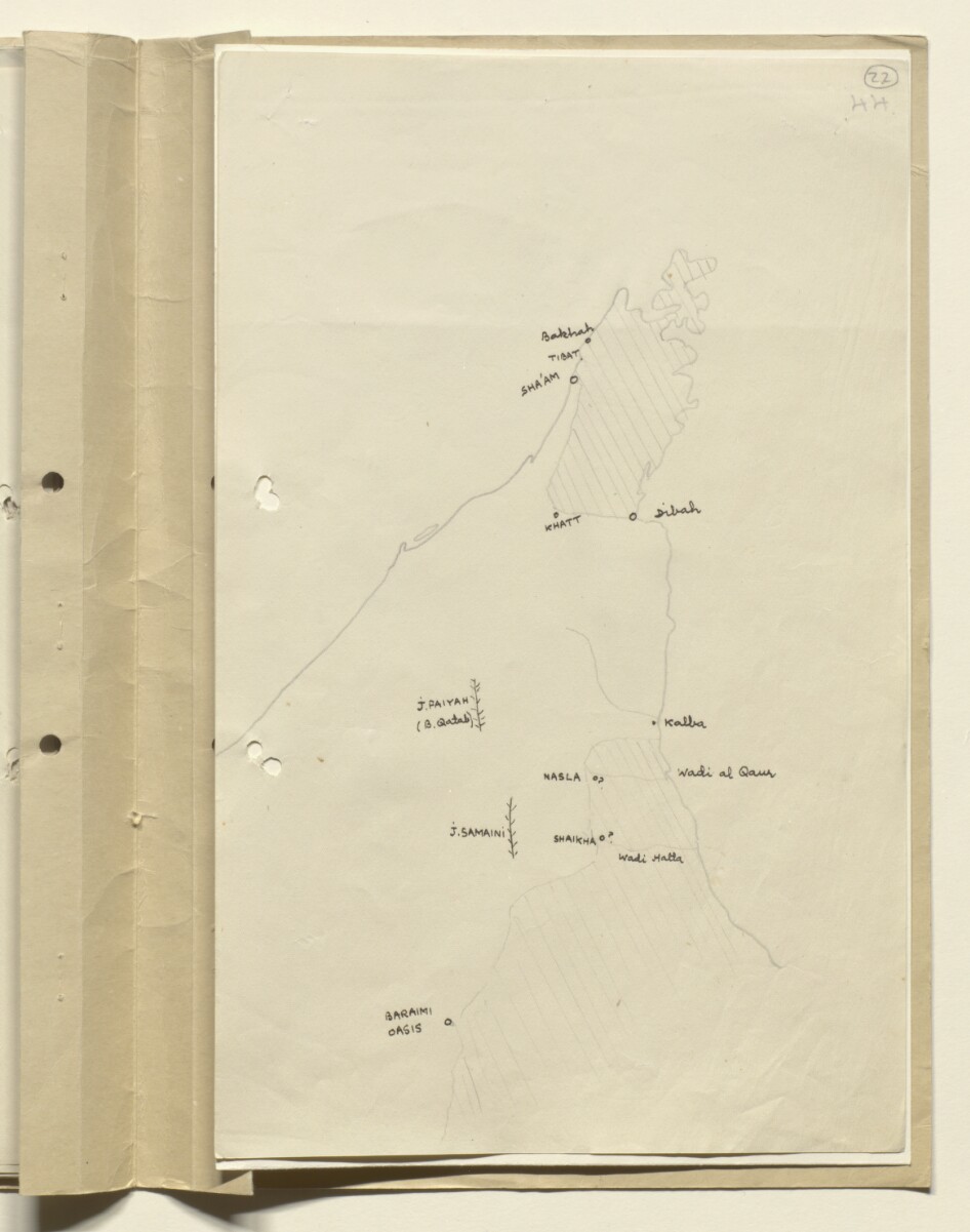
This sketch map shows the north-eastern part of the Arabian Peninsula, indicating boundaries, settlements and wadis (ravines or valleys which become watercourses during the rainy season). Scale not given.
- Extent and format
- 1 map
- Physical characteristics
Materials: Manuscript; pencil and black ink on paper.
Dimensions: 328 x 202mm.
- Written in
- English in Latin script View the complete information for this record
Use and share this item
- Share this item
Sketch Map of the North-Eastern Part of the Arabian Peninsula [22r] (1/2), British Library: India Office Records and Private Papers, IOR/R/15/6/186, f 22, in Qatar Digital Library <https://www.qdl.qa/archive/81055/vdc_100055765077.0x00002c> [accessed 18 April 2024]
https://www.qdl.qa/en/archive/81055/vdc_100055765077.0x00002c
Copy and paste the code below into your web page where you would like to embed the image.
<meta charset="utf-8"><a href="https://www.qdl.qa/en/archive/81055/vdc_100055765077.0x00002c">Sketch Map of the North-Eastern Part of the Arabian Peninsula [‎22r] (1/2)</a> <a href="https://www.qdl.qa/en/archive/81055/vdc_100055765077.0x00002c"> <img src="https://iiif.qdl.qa/iiif/images/81055/vdc_100000000831.0x000381/IOR_R_15_6_186_0043.jp2/full/!280,240/0/default.jpg" alt="" /> </a>
This record has a IIIF manifest available as follows. If you have a compatible viewer you can drag the icon to load it.https://www.qdl.qa/en/iiif/81055/vdc_100000000831.0x000381/manifestOpen in Universal viewerOpen in Mirador viewerMore options for embedding images
Copyright: How to use this content
- Reference
- IOR/R/15/6/186, f 22
- Title
- Sketch Map of the North-Eastern Part of the Arabian Peninsula
- Pages
- 22r:22v
- Author
- East India Company, the Board of Control, the India Office, or other British Government Department
- Usage terms
- Public Domain