!['Persian Plan of the Town and Fortifications of Bushire, previous to the bombardment by the British in 1856' [‎1r] (1/2)](https://iiif.qdl.qa/iiif/images/81055/vdc_100000005574.0x000001/IOR_X_3116_0001.jp2/full/!1200,1200/0/default.jpg "'Persian Plan of the Town and Fortifications of Bushire, previous to the bombardment by the British in 1856' [‎1r] (1/2)")
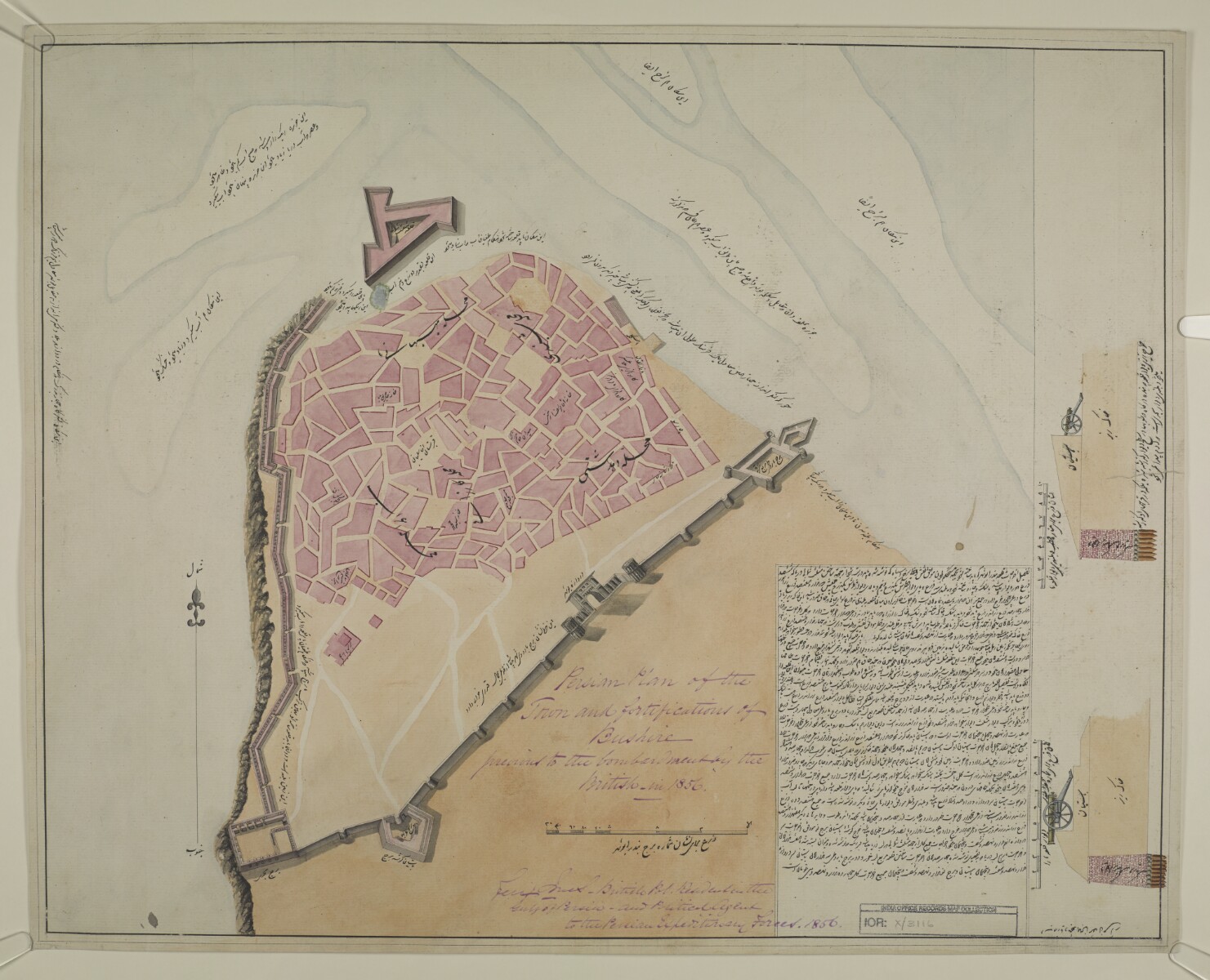
'Persian Plan of the Town and Fortifications of Bushire, previous to the bombardment by the British in 1856' [1r] (1/2)
The record is made up of 1 plan sheet. It was created in 1856. It was written in English and Persian. The original is part of the British Library: Map Collections.
About this item
- Content
Inscriptions:
Signed by Felix Jones, British Political Resident A senior ranking political representative (equivalent to a Consul General) from the diplomatic corps of the Government of India or one of its subordinate provincial governments, in charge of a Political Residency. in the Gulf of Persia, and Political Agent A mid-ranking political representative (equivalent to a Consul) from the diplomatic corps of the Government of India or one of its subordinate provincial governments, in charge of a Political Agency. to the Persian Expeditionary Forces.
- Extent and format
- 1 plan sheet
- Area map covers
- Map loading...
- Scale
- not given
- Scale designator
- Horizontal
- Orientation
- North
- Degree coordinates
- Top-left: 28° 59' 59.52" N, 50° 49' 18.83" E
Top-right: 28° 59' 59.52" N, 50° 50' 40.05" E
Bottom-left: 28° 58' 55.1" N, 50° 49' 18.83" E
Bottom-right: 28° 58' 55.1" N, 50° 50' 40.05" E - Physical characteristics
Materials:
Pen and ink with wash on paper
Dimensions:
446 x 560 mm, on sheet 466 x 580 mm
- Written in
- English and Persian in Latin script View the complete information for this record
Use and share this item
- Share this item
'Persian Plan of the Town and Fortifications of Bushire, previous to the bombardment by the British in 1856' [1r] (1/2), British Library: Map Collections, IOR/X/3116, in Qatar Digital Library <https://www.qdl.qa/archive/81055/vdc_100023416125.0x000002> [accessed 9 July 2026]
https://www.qdl.qa/en/archive/81055/vdc_100023416125.0x000002
Copy and paste the code below into your web page where you would like to embed the image.
<meta charset="utf-8"><a href="https://www.qdl.qa/en/archive/81055/vdc_100023416125.0x000002">'Persian Plan of the Town and Fortifications of Bushire, previous to the bombardment by the British in 1856' [‎1r] (1/2)</a> <a href="https://www.qdl.qa/en/archive/81055/vdc_100023416125.0x000002"> <img src="https://iiif.qdl.qa/iiif/images/81055/vdc_100000005574.0x000001/IOR_X_3116_0001.jp2/full/!280,240/0/default.jpg" alt="" /> </a>
This record has a IIIF manifest available as follows. If you have a compatible viewer you can drag the icon to load it.https://www.qdl.qa/en/iiif/81055/vdc_100000005574.0x000001/manifestOpen in Universal viewerOpen in Mirador viewerMore options for embedding images
Copyright: How to use this content
- Reference
- IOR/X/3116
- Title
- 'Persian Plan of the Town and Fortifications of Bushire, previous to the bombardment by the British in 1856'
- Pages
- 1r:1v
- Author
- Unknown
- Usage terms
- The copyright status is unknown. Please contact [email protected] with any information you have regarding this item.