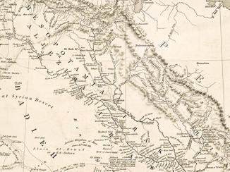
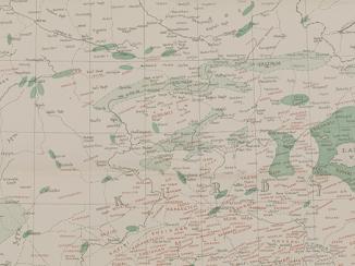
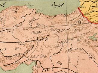
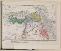
'Map 1. A Map of Turkey in Asia: map to illustrate the agreements of 1916 in regard to Asia Minor, Mesopotamia etc.'
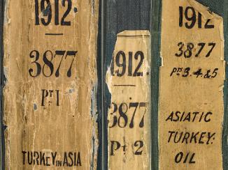
IOR/L/PS/18/D228, f 141
2 items in this record
Search within this record
The record is made up of 1 map. It was created in 1916. It was written in English. The original is part of the British Library: India Office The department of the British Government to which the Government of India reported between 1858 and 1947. The successor to the Court of Directors. Records and Private Papers Documents collected in a private capacity. .
About this record
- Content
This map illustrates the agreements of 1916 in regard to Asia Minor, Mesopotamia, and nearby areas, and is colour coded to reflect the 'spheres of influence' of the following countries in 1916:
- France;
- Britain;
- Italy;
- Russia;
- International (collective sphere).
The map is directly related to the synopsis (folios 136-137), and the agreements made with the French, Italians and Russians.
- Extent and format
- 1 map
- Area map covers
- Map loading...
- Scale
- Scale approximately 1:7,000,000
- Scale designator
- Horizontal
- Orientation
- North
- Degree coordinates
- Top-left: 44° 7' 8.76" N, 22° 55' 42.6" E
Top-right: 44° 7' 8.76" N, 53° 15' 42.12" E
Bottom-left: 28° 43' 10.2" N, 22° 55' 42.6" E
Bottom-right: 28° 43' 10.2" N, 53° 15' 42.12" E - It is part of
- 18 imagesRef: IOR/L/PS/18/D228
- Physical characteristics
Materials: 1 paper folio with coloured ink
- Written in
- English in Latin script
- Type
- Map
Archive information for this record
- Original held at
- British Library: India Office The department of the British Government to which the Government of India reported between 1858 and 1947. The successor to the Court of Directors. Records and Private Papers Documents collected in a private capacity.
- Access conditions
Unrestricted
- Archive reference
- IOR/L/PS/18/D228, f 141
- Date(s)
- 1916 (CE, Gregorian)
Access & Reference
History of this record
Related search terms
Use and share this record
- Share this record
- Cite this record in your research
'Map 1. A Map of Turkey in Asia: map to illustrate the agreements of 1916 in regard to Asia Minor, Mesopotamia etc.', British Library: India Office Records and Private Papers, IOR/L/PS/18/D228, f 141, in Qatar Digital Library <https://www.qdl.qa/archive/81055/vdc_100040050608.0x000003> [accessed 10 May 2024]
- Link to this record
https://www.qdl.qa/en/archive/81055/vdc_100040050608.0x000003
- IIIF details
This record has a IIIF manifest available as follows. If you have a compatible viewer you can drag the icon to load it.https://www.qdl.qa/en/iiif/81055/vdc_100000000833.0x00038a/manifestOpen in Universal viewerOpen in Mirador viewerMore options for embedding images
Copyright: How to use this content
- Reference
- IOR/L/PS/18/D228, f 141
- Title
- 'Map 1. A Map of Turkey in Asia: map to illustrate the agreements of 1916 in regard to Asia Minor, Mesopotamia etc.'
- Pages
- 141r:141v
- Author
- East India Company, the Board of Control, the India Office, or other British Government Department
- Usage terms
- Open Government Licence