![‘FIG. 2. Generalized Geological Map of Persia’ [‎19r] (1/2)](https://iiif.qdl.qa/iiif/images/81055/vdc_100000000884.0x0001e2/IOR_L_PS_20_C259_0043.jp2/full/!1200,1200/0/default.jpg "‘FIG. 2. Generalized Geological Map of Persia’ [‎19r] (1/2)")
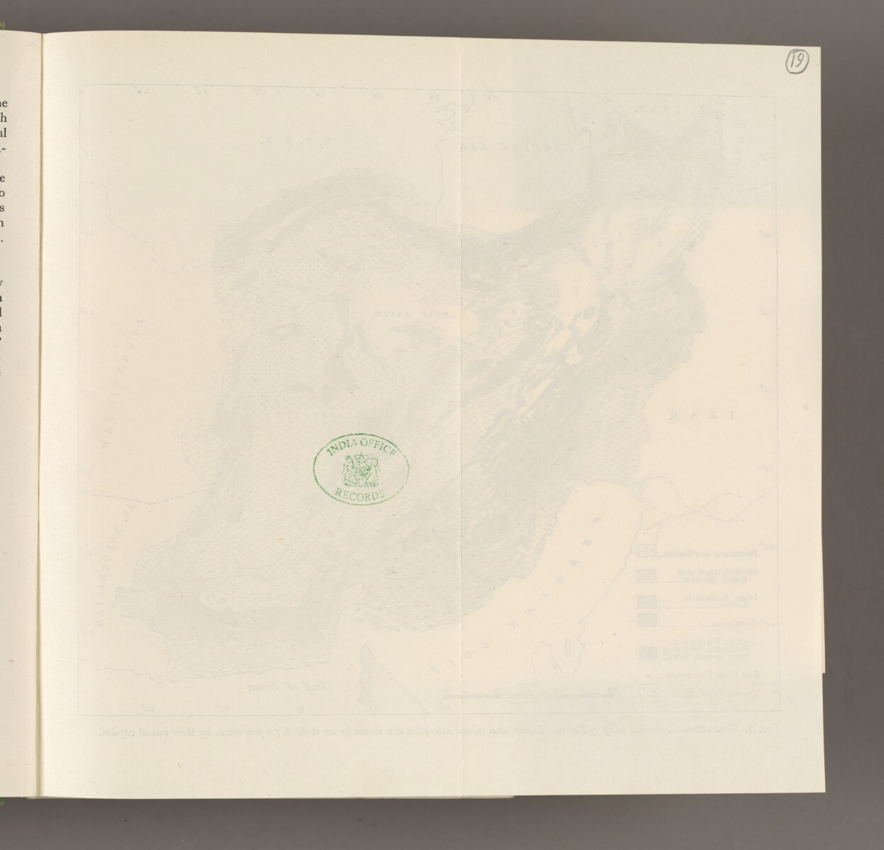
‘FIG. 2. Generalized Geological Map of Persia’ [19r] (1/2)
The record is made up of 1 map sheet. It was created in Sep 1945. It was written in English. The original is part of the British Library: India Office The department of the British Government to which the Government of India reported between 1858 and 1947. The successor to the Court of Directors. Records and Private Papers Documents collected in a private capacity. .
About this item
- Content
A geological map of Persia [Iran]. Rock types are indicated on the map with different patterns. Salt plugs in southern Persia are indicated by black dots. The map also indicates the Great Kavir [Dasht-e Kavir] and Dasht-i-Lut [Dasht-e Lut] deserts. Other kavirs [deserts] are marked with a ‘K’ in italics. Some major cities are indicated by their first letter, e.g. ‘T’[abriz]. Areas which have not been subject to geological studies are marked with a question mark. International borders are indicated with dotted lines.
- Extent and format
- 1 map sheet
- Area map covers
- Map loading...
- Scale
- Scale: 1:10058400
- Scale designator
- Horizontal
- Degree coordinates
- Top-left: 38° 0' 0" N, 44° 0' 0" E
Top-right: 38° 0' 0" N, 64° 0' 0" E
Bottom-left: 26° 0' 0" N, 44° 0' 0" E
Bottom-right: 26° 0' 0" N, 64° 0' 0" E - Physical characteristics
Materials: Printed on paper
Dimensions: 202 x 177mm, on sheet 230 x 211mm
- Written in
- English in Latin script View the complete information for this record
Use and share this item
- Share this item
‘FIG. 2. Generalized Geological Map of Persia’ [19r] (1/2), British Library: India Office Records and Private Papers, IOR/L/PS/20/C259, f 19, in Qatar Digital Library <https://www.qdl.qa/archive/81055/vdc_100180836496.0x00000a> [accessed 27 July 2024]
https://www.qdl.qa/en/archive/81055/vdc_100180836496.0x00000a
Copy and paste the code below into your web page where you would like to embed the image.
<meta charset="utf-8"><a href="https://www.qdl.qa/en/archive/81055/vdc_100180836496.0x00000a">‘FIG. 2. Generalized Geological Map of Persia’ [‎19r] (1/2)</a> <a href="https://www.qdl.qa/en/archive/81055/vdc_100180836496.0x00000a"> <img src="https://iiif.qdl.qa/iiif/images/81055/vdc_100000000884.0x0001e2/IOR_L_PS_20_C259_0043.jp2/full/!280,240/0/default.jpg" alt="" /> </a>
This record has a IIIF manifest available as follows. If you have a compatible viewer you can drag the icon to load it.https://www.qdl.qa/en/iiif/81055/vdc_100000000884.0x0001e2/manifestOpen in Universal viewerOpen in Mirador viewerMore options for embedding images
Copyright: How to use this content
- Reference
- IOR/L/PS/20/C259, f 19
- Title
- ‘FIG. 2. Generalized Geological Map of Persia’
- Pages
- 19r:19v
- Author
- East India Company, the Board of Control, the India Office, or other British Government Department
- Usage terms
- Public Domain