![‘SKETCH MAP OF PERSIAN GULF.’ [‎445r] (1/2)](https://iiif.qdl.qa/iiif/images/81055/vdc_100000000466.0x0002e6/IOR_L_PS_10_1276_0902.jp2/full/!1200,1200/0/default.jpg "‘SKETCH MAP OF PERSIAN GULF.’ [‎445r] (1/2)")
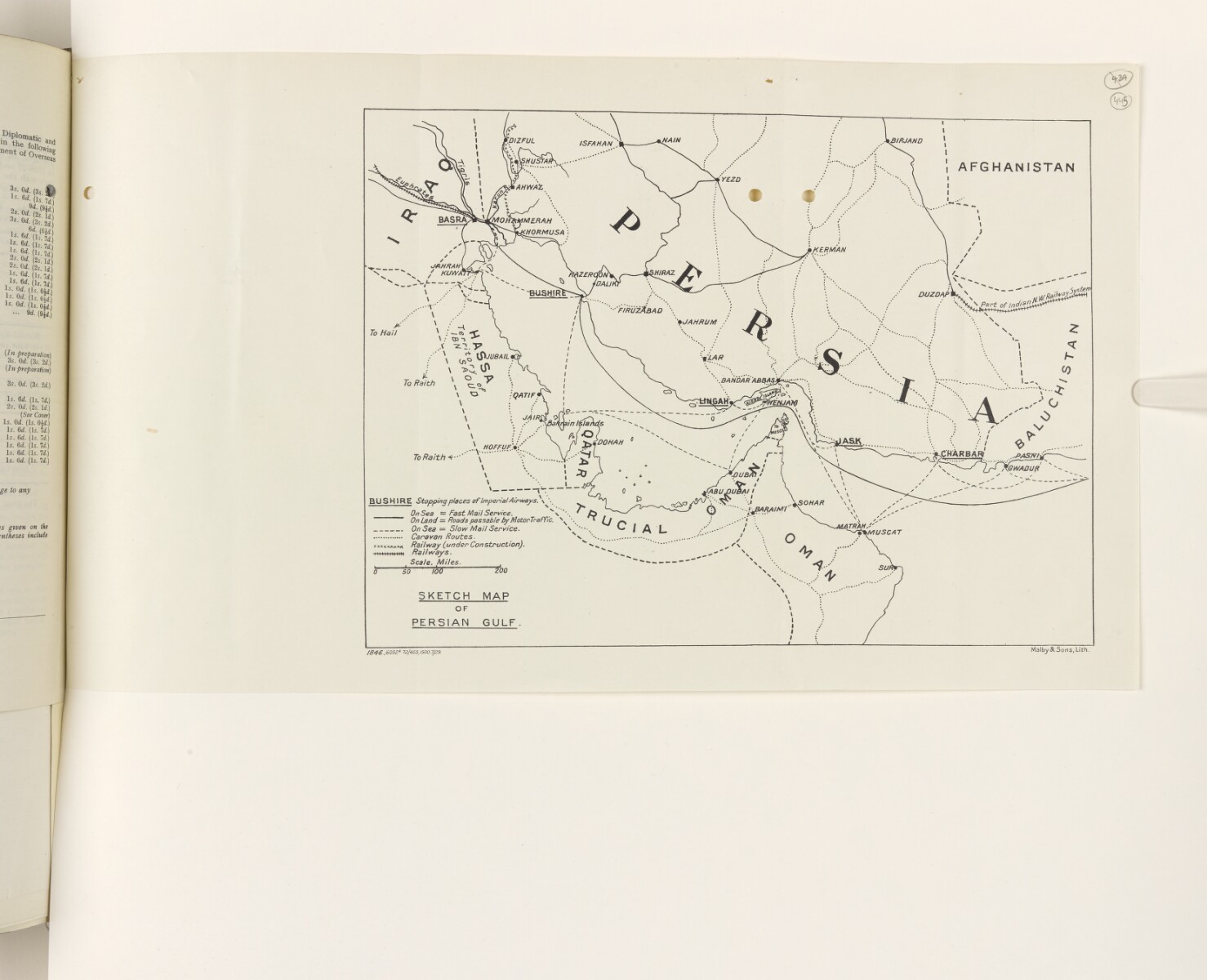
‘SKETCH MAP OF PERSIAN GULF.’ [445r] (1/2)
The record is made up of 1 map. It was created in c 1929. It was written in English. The original is part of the British Library: India Office The department of the British Government to which the Government of India reported between 1858 and 1947. The successor to the Court of Directors. Records and Private Papers Documents collected in a private capacity. .
About this item
- Content
This sketch map shows the Persian Gulf The historical term used to describe the body of water between the Arabian Peninsula and Iran. , and the surrounding land. Place names are given, borders are indicated by dashed lines, and the map includes a key indicating how the following features are represented on the map: stopping places of Imperial Airways; the fast mail service by sea; the slow mail service by sea; roads passable by motor traffic; caravan routes; railways; and railways under construction.
Scale not given.
- Extent and format
- 1 map
- Area map covers
- Map loading...
- Orientation
- North
- Degree coordinates
- Top-left: 33° 14' 49.2" N, 46° 0' 11.16" E
Top-right: 33° 14' 49.2" N, 64° 44' 44.88" E
Bottom-left: 20° 55' 28.56" N, 46° 0' 11.16" E
Bottom-right: 20° 55' 28.56" N, 64° 44' 44.88" E - Physical characteristics
Materials: Printed in black and white on paper
Dimensions: 201 x 276mm on sheet 240 x 413mm
- Written in
- English in Latin script View the complete information for this record
Use and share this item
- Share this item
‘SKETCH MAP OF PERSIAN GULF.’ [445r] (1/2), British Library: India Office Records and Private Papers, IOR/L/PS/10/1276, f 445, in Qatar Digital Library <https://www.qdl.qa/archive/81055/vdc_100078989258.0x000066> [accessed 4 May 2024]
https://www.qdl.qa/en/archive/81055/vdc_100078989258.0x000066
Copy and paste the code below into your web page where you would like to embed the image.
<meta charset="utf-8"><a href="https://www.qdl.qa/en/archive/81055/vdc_100078989258.0x000066">‘SKETCH MAP OF PERSIAN GULF.’ [‎445r] (1/2)</a> <a href="https://www.qdl.qa/en/archive/81055/vdc_100078989258.0x000066"> <img src="https://iiif.qdl.qa/iiif/images/81055/vdc_100000000466.0x0002e6/IOR_L_PS_10_1276_0902.jp2/full/!280,240/0/default.jpg" alt="" /> </a>
This record has a IIIF manifest available as follows. If you have a compatible viewer you can drag the icon to load it.https://www.qdl.qa/en/iiif/81055/vdc_100000000466.0x0002e6/manifestOpen in Universal viewerOpen in Mirador viewerMore options for embedding images
Copyright: How to use this content
- Reference
- IOR/L/PS/10/1276, f 445
- Title
- ‘SKETCH MAP OF PERSIAN GULF.’
- Pages
- 445r:445v
- Author
- Malby and Sons
- Usage terms
- Public Domain