Show menu
Search form
Search the site
Explore Qatar Digital Library
Articles From Our Experts
Glossary
About
العربية
English
Search form
Search the site
العربية
English
Articles From Our Experts
Filter articles by:
What
Introductory Articles
(5)
Arabic Manuscripts
(0)
Maps
(6)
The British Empire in the Gulf
(1)
Commerce and Communication
(0)
People and Places
(1)
Culture and Religion
(0)
Sciences and Medicine
(0)
Power and Politics
(0)
Sound and Music
(0)
Introductory Articles
(5)
Arabic Manuscripts
(0)
Maps
(6)
The British Empire in the Gulf
(1)
Commerce and Communication
(0)
People and Places
(1)
Culture and Religion
(0)
Sciences and Medicine
(0)
Power and Politics
(0)
Sound and Music
(0)
Where
Bahrain
(0)
Egypt
(0)
India
(0)
Iran
(0)
Iraq
(0)
Kuwait
(0)
Oman
(1)
Pakistan
(0)
Qatar
(0)
Saudi Arabia
(0)
United Arab Emirates
(0)
Yemen
(0)
Bahrain
(0)
Egypt
(0)
India
(0)
Iran
(0)
Iraq
(0)
Kuwait
(0)
Oman
(1)
Pakistan
(0)
Qatar
(0)
Saudi Arabia
(0)
United Arab Emirates
(0)
Yemen
(0)
When
Pre-1600
(0)
1600–1649
(0)
1650–1699
(0)
1700–1749
(0)
1750–1799
(0)
1800‒1849
(1)
1850‒1899
(0)
1900–1949
(0)
1950–1999
(0)
Pre-1600
(0)
1600–1649
(0)
1650–1699
(0)
1700–1749
(0)
1750–1799
(0)
1800‒1849
(1)
1850‒1899
(0)
1900–1949
(0)
1950–1999
(0)
5
of
276
articles to explore
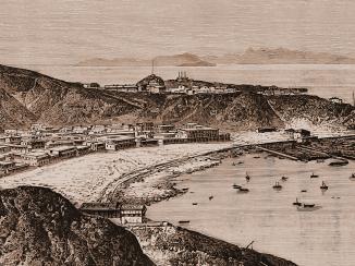
Only by mapping and surveying Aden fully were the British able to plan for its reconstruction and fortification, thereby facilitating trade and other shipping to and from India and beyond.
Mapping Aden: The British Occupation of A Vital Trading Port
By charting waters within and creating accurate maps of their spheres of influence the East India company, and later India Office, ensured that they had an advantage over competing powers.
India Office Records Map Collection: A Vast and Powerful Resource
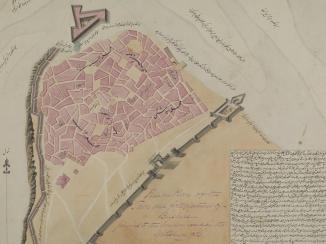
This article looks at the India Office Records Map Collection’s holdings relating to the Arabian Peninsula and The Gulf. It considers why the India Office assembled such a significant collection for so distant a region, and outlines the variety and organisation of the material.
Maps of the Arabian Peninsula and The Gulf in the India Office Records Map Collection
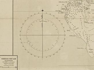
A deep dive into the world of surveying and the techniques used to produce maps. This is the second article in a series of five by the author, explaining cartographic terminology.
Part 2 – The Language of Maps: Surveyors of all they see
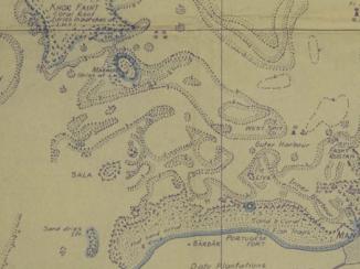
A vast array of cartographic material has been hidden amongst the India Office Records’ administrative files; this material provides a fascinating insight into the workings of British imperial knowledge gathering in the Gulf and beyond.
Cartographic Material in India Office Reports
http://www.qdl.qa/en/articles-from-our-experts?themes%5B0%5D=3472