'Sketch of the Peninsula from Bushire to Hallela Surveyed by Captain Shewell Assistant Quarter Master General and Head Guide Govindrow 1st Division P.E.F.F.’
Mss Eur F126/102


2 items in this record
Search within this record
The record is made up of 1 map. It was created in 15 Jul 1863. It was written in English. The original is part of the British Library: India Office The department of the British Government to which the Government of India reported between 1858 and 1947. The successor to the Court of Directors. Records and Private Papers Documents collected in a private capacity. .
About this record
- Content
Distinctive Features:
Copy produced by the Quarter Master General's Office, Poona, 15 July 1863. The original map was drawn up by A. Quarter Master General's Office 1st Division P.E.F.F. [Persian Expeditionary Field Force], Bushire, May 1857. Signed W V Shewell Captain, Assistant Quarter Master General 1st Division P.E.F.F.
Relief shown by shading.
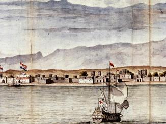
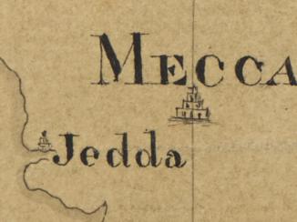
The map shows the town of Reshire and the fortifications of Bushire and Reshire on the Bushire Peninsula. The map has been coloured with brown to represent land, and blue to represent water.
- Extent and format
- 1 map
- Area map covers
- Map loading...
- Scale
- Scale approximately 1:14,400
- Scale designator
- Horizontal
- Orientation
- North
- Degree coordinates
- Top-left: 28° 59' 50.17" N, 50° 48' 11.89" E
Top-right: 28° 59' 50.17" N, 50° 53' 43.09" E
Bottom-left: 28° 49' 59.5" N, 50° 48' 11.89" E
Bottom-right: 28° 49' 59.5" N, 50° 53' 43.09" E - Physical characteristics
Materials: Pen and ink with wash on tracing cloth
Dimensions: 1400 x 710 mm, on sheet 1437 x 731 mm
Condition: Small holes and tears along several fold lines
Foliation: The map sheet has been foliated in the top right hand corner of the folio with a pencil number enclosed in a circle.
- Written in
- English in Latin script
- Type
- Map
Archive information for this record
- Original held at
- British Library: India Office The department of the British Government to which the Government of India reported between 1858 and 1947. The successor to the Court of Directors. Records and Private Papers Documents collected in a private capacity.
- Access conditions
Unrestricted
- Archive reference
- Mss Eur F126/102
- Date(s)
- 15 Jul 1863 (CE, Gregorian)
Access & Reference
History of this record
Related search terms
- Places
- Bushire
Use and share this record
- Share this record
- Cite this record in your research
'Sketch of the Peninsula from Bushire to Hallela Surveyed by Captain Shewell Assistant Quarter Master General and Head Guide Govindrow 1st Division P.E.F.F.’, British Library: India Office Records and Private Papers, Mss Eur F126/102, in Qatar Digital Library <https://www.qdl.qa/archive/81055/vdc_100000001524.0x0003d9> [accessed 29 June 2026]
- Link to this record
https://www.qdl.qa/en/archive/81055/vdc_100000001524.0x0003d9
- IIIF details
This record has a IIIF manifest available as follows. If you have a compatible viewer you can drag the icon to load it.https://www.qdl.qa/en/iiif/81055/vdc_100000001524.0x0003d9/manifestOpen in Universal viewerOpen in Mirador viewerMore options for embedding images
Copyright: How to use this content
- Reference
- Mss Eur F126/102
- Title
- 'Sketch of the Peninsula from Bushire to Hallela Surveyed by Captain Shewell Assistant Quarter Master General and Head Guide Govindrow 1st Division P.E.F.F.’
- Pages
- 1r:1v
- Author
- East India Company, the Board of Control, the India Office, or other British Government Department
- Usage terms
- Open Government Licence