‘MAP OF BASRA AND MAGIL’
IOR/L/MIL/17/15/55, f 42

2 items in this record
Search within this record
The record is made up of 1 map. It was created in 30 Jan 1919. It was written in English. The original is part of the British Library: India Office The department of the British Government to which the Government of India reported between 1858 and 1947. The successor to the Court of Directors. Records and Private Papers Documents collected in a private capacity. .
About this record
- Content
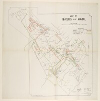
The map shows the state of the roads in and around Basra City. Different categories of roads are highlighted in different colours as follows: concrete roads (solid red line), metalled roads (red dashes), proposed metalled roads (small red dashes), kutcha roads (solid green line), proposed kutcha roads (green dashes), civil roads (yellow), and proposed civil roads (yellow dashes). A reference key for the map can be found in the top right corner.
The scale of the map is 3 inches to 1 mile.
The map includes two printing statements ‘Reproduced by Basrah Survey Party I.E.F.D No. 81 Dated 12.6.17’ and ‘Reproduced by Survey Party M.E.F. No. 339 Dated 30-1-19’.
- Extent and format
- 1 map
- Area map covers
- Map loading...
- Scale
- 1:21,120
- Scale designator
- Horizontal
- Orientation
- North
- Degree coordinates
- Top-left: 30° 35' 0.23" N, 47° 44' 41.51" E
Top-right: 30° 35' 0.23" N, 47° 53' 21.85" E
Bottom-left: 30° 26' 50.43" N, 47° 44' 41.51" E
Bottom-right: 30° 26' 50.43" N, 47° 53' 21.85" E - It is part of
- 94 imagesRef: IOR/L/MIL/17/15/55
- Physical characteristics
Materials: Printed on paper
Dimensions: 645 x 640mm
- Written in
- English in Latin script
- Type
- Map
Archive information for this record
- Original held at
- British Library: India Office The department of the British Government to which the Government of India reported between 1858 and 1947. The successor to the Court of Directors. Records and Private Papers Documents collected in a private capacity.
- Access conditions
Unrestricted
- Archive reference
- IOR/L/MIL/17/15/55, f 42
- Date(s)
- 30 Jan 1919 (CE, Gregorian)
Access & Reference
History of this record
Use and share this record
- Share this record
- Cite this record in your research
‘MAP OF BASRA AND MAGIL’, British Library: India Office Records and Private Papers, IOR/L/MIL/17/15/55, f 42, in Qatar Digital Library <https://www.qdl.qa/archive/81055/vdc_100042400916.0x000002> [accessed 10 July 2026]
- Link to this record
https://www.qdl.qa/en/archive/81055/vdc_100042400916.0x000002
- IIIF details
This record has a IIIF manifest available as follows. If you have a compatible viewer you can drag the icon to load it.https://www.qdl.qa/en/iiif/81055/vdc_100000000239.0x00016f/manifestOpen in Universal viewerOpen in Mirador viewerMore options for embedding images
Copyright: How to use this content
- Reference
- IOR/L/MIL/17/15/55, f 42
- Title
- ‘MAP OF BASRA AND MAGIL’
- Pages
- 42r:42v
- Author
- East India Company, the Board of Control, the India Office, or other British Government Department
- Usage terms
- Open Government Licence