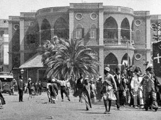
Maps Relating to the First World War in the Former Ottoman Empire
Mss Eur F112/552






30 items in this record
Search within this record
The record is made up of 15 map sheets. It was created in 1906-1918. It was written in English. The original is part of the British Library: India Office The department of the British Government to which the Government of India reported between 1858 and 1947. The successor to the Court of Directors. Records and Private Papers Documents collected in a private capacity. .
About this record
- Content
Maps Relating to the First World War in the former Ottoman Empire. As follows:
- f 1 Northern Persia [Iran] and Caucasia: map fragment [1916?]
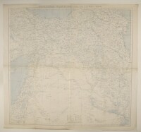
- f 2 The Ottoman Empire north of 33°N. 1916
- ff 3-4 'Arabia and Middle East'. Friendly and hostile confederations. [1916?]
- f 5 'The Middle East'. Published by 'Admiralty War Staff I[ntelligence].D[ivision].' [1914]
- f 6 'Russian Turkistan to accompany Military Report on Russian Turkistan'. Published by the General Staff India, 1914
- f 7 'Map of Eastern Turkey in Asia, Syria and Western Persia'. With manuscript annotations relating to the Hejaz railway. 1915-[1917?]
- f 8 'Persia and Afghanistan'. Published by the War Office, 1912
- f 9 'Persia and Afghanistan'. Published by the War Office, 1916
- f 10 'Sketch map of Arabia'. With manuscript additions showing 'Friendly' and 'Hostile' Confederations. 1906-[1916?]
- f 11 'A Map of the Countries Between Constantinople and Calcutta [Kolkata] including Turkey in Asia, Persia, Afghanistan & Turkestan.' Western portion only. With manuscript additions showing the positions of military forces and updates to communications. Published by Edward Stanford, Ltd, 1912. 1912-[1917?]
- f 12 'A Map of the Countries Between Constantinople and Calcutta including Turkey in Asia, Persia, Afghanistan & Turkestan.' Western portion only. With manuscript additions showing the positions of religious sites, naval bases, oil sites and updated railway information. Published by Edward Stanford, Ltd, 1912. 1912-[1917?]
- f 13 'Medina-Mecca. Published by the Survey of Egypt for Arab Bureau; under authority from the War Office, Nov. 1916.' With manuscript additions showing the disposition of troops
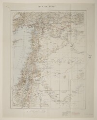
- f 14 'Map of Syria'. With manuscript additions. Created by the War Office, December 1918
- f 15 'Portion of Chart No. 748B showing sea line within which lies the Arabian Peninsula.' [1918?].
- Extent and format
- 15 map sheets
- It is grouped into
- 2 imagesRef: Mss Eur F112/552, f 12 imagesRef: Mss Eur F112/552, f 24 imagesRef: Mss Eur F112/552, ff 3-42 imagesRef: Mss Eur F112/552, f 52 imagesRef: Mss Eur F112/552, f 62 imagesRef: Mss Eur F112/552, f 72 imagesRef: Mss Eur F112/552, f 82 imagesRef: Mss Eur F112/552, f 92 imagesRef: Mss Eur F112/552, f 102 imagesRef: Mss Eur F112/552, f 112 imagesRef: Mss Eur F112/552, f 122 imagesRef: Mss Eur F112/552, f 132 imagesRef: Mss Eur F112/552, f 142 imagesRef: Mss Eur F112/552, f 15
- Written in
- English in Latin script
- Type
- Archival file
Archive information for this record
- Original held at
- British Library: India Office The department of the British Government to which the Government of India reported between 1858 and 1947. The successor to the Court of Directors. Records and Private Papers Documents collected in a private capacity.
- Access conditions
Unrestricted
- Archive reference
- Mss Eur F112/552
- Date(s)
- 1906-1918 (CE, Gregorian)
Access & Reference
History of this record
Related search terms
- Subjects
- Turkey--History--Ottoman Empire, 1288-1918
- Places
- Ottoman Empire
Use and share this record
- Share this record
- Cite this record in your research
Maps Relating to the First World War in the Former Ottoman Empire, British Library: India Office Records and Private Papers, Mss Eur F112/552, in Qatar Digital Library <https://www.qdl.qa/archive/81055/vdc_100000001491.0x000249> [accessed 17 July 2026]
- Link to this record
https://www.qdl.qa/en/archive/81055/vdc_100000001491.0x000249
- IIIF details
This record has a IIIF manifest available as follows. If you have a compatible viewer you can drag the icon to load it.https://www.qdl.qa/en/iiif/81055/vdc_100000001491.0x000249/manifestOpen in Universal viewerOpen in Mirador viewerMore options for embedding images
Copyright: How to use this content
- Reference
- Mss Eur F112/552, f 1
- Title
- Northern Persia and Caucasia: map fragment
- Pages
- 1r:1v
- Author
- Unknown
- Usage terms
- The copyright status is unknown. Please contact [email protected] with any information you have regarding this item.
- Reference
- Mss Eur F112/552, f 1
- Title
- Northern Persia and Caucasia: map fragment
- Pages
- 1r:1v
- Author
- Unknown
- Usage terms
- The copyright status is unknown. Please contact [email protected] with any information you have regarding this item.
- Reference
- Mss Eur F112/552, f 2
- Title
- The Ottoman Empire north of 33°N
- Pages
- 2r:2v
- Author
- Unknown
- Usage terms
- The copyright status is unknown. Please contact [email protected] with any information you have regarding this item.
- Reference
- Mss Eur F112/552, ff 3-4
- Title
- 'Arabia and Middle East'. 'Friendly' and 'hostile' confederations
- Pages
- 3r:4v
- Author
- Unknown
- Usage terms
- The copyright status is unknown. Please contact [email protected] with any information you have regarding this item.
- Reference
- Mss Eur F112/552, f 5
- Title
- 'The Middle East'
- Pages
- 5r:5v
- Author
- Admiralty
- Usage terms
- Public Domain
- Reference
- Mss Eur F112/552, f 6
- Title
- 'Russian Turkistan to accompany Military Report on Russian Turkistan'
- Pages
- 6r:6v
- Author
- Survey of India, Map Record Office
- Usage terms
- Public Domain
- Reference
- Mss Eur F112/552, f 6
- Title
- 'Russian Turkistan to accompany Military Report on Russian Turkistan'
- Pages
- 6r:6v
- Author
- General Staff Branch, India
- Usage terms
- Public Domain
- Reference
- Mss Eur F112/552, f 7
- Title
- 'Map of Eastern Turkey in Asia, Syria and Western Persia'. With manuscript annotations relating to the Hejaz railway
- Pages
- 7r:7v
- Author
- Royal Geographical Society
- Usage terms
- Public Domain
- Reference
- Mss Eur F112/552, f 8
- Title
- 'Persia and Afghanistan'
- Pages
- 8r:8v
- Author
- War Office
- Usage terms
- Public Domain
- Reference
- Mss Eur F112/552, f 9
- Title
- 'Persia and Afghanistan'
- Pages
- 9r:9v
- Author
- War Office
- Usage terms
- Public Domain
- Reference
- Mss Eur F112/552, f 10
- Title
- 'Sketch map of Arabia'. With manuscript additions showing 'Friendly' and 'Hostile' Confederations
- Pages
- 10r:10v
- Author
- War Office
- Usage terms
- Open Government Licence
- Reference
- Mss Eur F112/552, f 10
- Title
- 'Sketch map of Arabia'. With manuscript additions showing 'Friendly' and 'Hostile' Confederations
- Pages
- 10r:10v
- Author
- War Office
- Usage terms
- Public Domain
- Reference
- Mss Eur F112/552, f 11
- Title
- 'A Map of the Countries Between Constantinople and Calcutta including Turkey in Asia, Persia, Afghanistan & Turkestan.' Western portion only. With manuscript additions showing the positions of military forces and updates to communications
- Pages
- 11r:11v
- Author
- Edward Stanford & Co, publishers and stationers
- Usage terms
- Public Domain
- Reference
- Mss Eur F112/552, f 11
- Title
- 'A Map of the Countries Between Constantinople and Calcutta including Turkey in Asia, Persia, Afghanistan & Turkestan.' Western portion only. With manuscript additions showing the positions of military forces and updates to communications
- Pages
- 11r:11v
- Author
- War Office
- Usage terms
- Open Government Licence
- Reference
- Mss Eur F112/552, f 12
- Title
- 'A Map of the Countries Between Constantinople and Calcutta including Turkey in Asia, Persia, Afghanistan & Turkestan.' Western portion only. With manuscript additions showing the positions of religious sites, naval bases, oil sites and updated railway information
- Pages
- 12r:12v
- Author
- War Office
- Usage terms
- Open Government Licence
- Reference
- Mss Eur F112/552, f 12
- Title
- 'A Map of the Countries Between Constantinople and Calcutta including Turkey in Asia, Persia, Afghanistan & Turkestan.' Western portion only. With manuscript additions showing the positions of religious sites, naval bases, oil sites and updated railway information
- Pages
- 12r:12v
- Author
- Edward Stanford & Co, publishers and stationers
- Usage terms
- Public Domain
- Reference
- Mss Eur F112/552, f 13
- Title
- 'Medina-Mecca. Published by the Survey of Egypt for Arab Bureau; under authority from the War Office, Nov. 1916.' With manuscript additions showing the disposition of troops
- Pages
- 13r:13v
- Author
- Survey of Egypt
- Usage terms
- Public Domain
- Reference
- Mss Eur F112/552, f 13
- Title
- 'Medina-Mecca. Published by the Survey of Egypt for Arab Bureau; under authority from the War Office, Nov. 1916.' With manuscript additions showing the disposition of troops
- Pages
- 13r:13v
- Author
- Unknown
- Usage terms
- The copyright status is unknown. Please contact [email protected] with any information you have regarding this item.
- Reference
- Mss Eur F112/552, f 13
- Title
- 'Medina-Mecca. Published by the Survey of Egypt for Arab Bureau; under authority from the War Office, Nov. 1916.' With manuscript additions showing the disposition of troops
- Pages
- 13r:13v
- Author
- Survey of Egypt
- Usage terms
- Open Government Licence
- Reference
- Mss Eur F112/552, f 13
- Title
- 'Medina-Mecca. Published by the Survey of Egypt for Arab Bureau; under authority from the War Office, Nov. 1916.' With manuscript additions showing the disposition of troops
- Pages
- 13r:13v
- Author
- War Office
- Usage terms
- Public Domain
- Reference
- Mss Eur F112/552, f 14
- Title
- 'Map of Syria'. With manuscript additions
- Pages
- 14r:14v
- Author
- War Office
- Usage terms
- Public Domain
- Reference
- Mss Eur F112/552, f 14
- Title
- 'Map of Syria'. With manuscript additions
- Pages
- 14r:14v
- Author
- War Office
- Usage terms
- Open Government Licence
- Reference
- Mss Eur F112/552, f 15
- Title
- 'Portion of Chart No. 748B showing sea line within which lies the Arabian Peninsula.'
- Pages
- 15r:15v
- Author
- War Office
- Usage terms
- Public Domain
- Reference
- Mss Eur F112/552, f 15
- Title
- 'Portion of Chart No. 748B showing sea line within which lies the Arabian Peninsula.'
- Pages
- 15r:15v
- Author
- War Office
- Usage terms
- Open Government Licence